
 | ||
Weather 9°C, Wind W at 13 km/h, 88% Humidity Similar Valley of Rephaim, Tyropoeon Valley, Beracah | ||
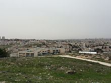
Gibeah (/ˈɡɪbiə/; Hebrew: גבעה Giv'a) is a place name appearing in several books of the Bible. It is generally identified with a hill in Jerusalem, on the outskirts of the Pisgat Ze'ev and Shuafat neighborhoods, known as Tell el-Ful. However, this identification was challenged by Israel Finkelstein in 2011.
Contents
Map of Tall al Ful, Jerusalem
Etymology
Gibeah may be a variation of the Hebrew word meaning “hill,” other names include Gibeah of God (גִּבְעַת הָאֱלֹהִים) Gibeah of Benjamin (גִּבְעַת בִּנְיָמִין) for it is in the territory of the Tribe of Benjamin and Gibeah of Saul (גִּבְעַת שָׁאוּל) where the biblical King Saul lived.
Geography
Gibeah is believed to be located along the Central Benjamin Plateau, 3 miles (4.8 km) north of Jerusalem along the Watershed Ridge at 2,754 feet (839 m) above sea level.
History
Archaeology
The site was first excavated in 1868 by Charles Warren, while C.R. Conder described the remains in 1874. William F. Albright led his first excavation from 1922 to 1923, and returned for a second season in 1923. His work was published in 1960. P.W. Lapp conducted a six-week salvage excavation in 1964. According to Kenneth Kitchen "Upon this strategic point was found an Iron I occupation replaced (at an interval) by a fortress ("I"), subsequently refurbished ("II"), and then later in disuse. The oldest level may reflect the Gibeah of Judg 19-20. The excavations by Albright, checked by Lapp, would favor the view that it was Saul who built the first fortress, later repaired by him or David. the first fort (quadrangular) had at least one rectangular corner-tower at its southwest angle; it may have had others at the other corners, but no traces were detected."