
Local time Monday 7:22 PM | ||
 | ||
Weather 20°C, Wind NW at 3 km/h, 41% Humidity | ||
Ghosi is a town in Mau district, Uttar Pradesh, India, having population around fifty thousand. Ghosi has a mixed community, with 58% Muslims and 41% Hindus. Ghosi is one of the oldest tehsils in Uttar Pradesh, with its own Loksabha and Vidhan Sabha seats.
Contents
- Map of Ghosi Uttar Pradesh 275304
- History
- Geography
- Administration
- Education
- Economy
- Climate
- Area
- Sport
- Architecture
- Culture
- Transport
- Politics
- Demographics
- References
Map of Ghosi, Uttar Pradesh 275304
History
Ghosi was established by its king Nahoos around 1535. He formerly lived at Qasba khas where he built his Palace at Court 'Koat', where ASI has found archaeological evidence of his rule.
During the British Raj, Madhuban was the Koatwali of the region, and there was resistance to British rule.
After Indian independence Ghosi became a Lok Sabha constituency (Hindi: घोसी लोक सभा निर्वाचन क्षेत्र) and also a Vidhan Sabha (legislative assembly) constituency. Lok Sabha constituency and Vidhan Sabha.
Geography
Ghosi is a city in the eastern part of the state of Uttar Pradesh in India. It is located at 26.11°N 83.54°E / 26.11; 83.54, and has an average elevation of 68 metres (223 feet). Ghosi is situated at plain 'Maidani Area' Ganges, Ghaghra, Tons and Tamsa rivers
Administration
Ghosi is a sub division in Mau District in Uttar Pradesh. The administration of the town is managed by S.D.M. This also Nagar Panchayat which have to elect by the peoples of Ghosi Urban area
Education
Educational institutes Up to Higher Secondary, local schools include Shamsul Olum High School, Askari Memorial High School, Oriental English School, Swami Vivekanand, Srasvati Vidya Mandir, Zainabia High School, St. Norbert, St. Xavier's high school, Adam Public School, Sarvoday Inter College,Jaish Kishan Inter College and G.M Convent School.
Degree colleges include Sarvoday P.G. College and Ramlagan P.G. College.
Ghosi has a larger number of madrasas for Islamic education. Madasa Husainia was established in 1943 by the supreme ulamas at that time. Other madrasas include Allama Syed Rahat Husain, Allama Zia-ul-Mustafa etc.Other important religious institutes are Jamia Amjadia Razvia, Jamia Shamsul Oloom Arabic College, Jamia Raza-e-Umar, Darul Oloom Khairul Madaris, Darul Oloom Khairiah Faiz-e-Aam, Darul Oloom, Badrul Oloom, Nasirul Oloom, and Darul Oloom Mohammadiah.
Girls' institutes include Kulliatul Banat-al-Amjadia, and Shamsul Oloom Niswan.
Economy
Out of total population, 12,387 were engaged in work or business activity. Of this 8,850 were males while 3,537 were females. In census survey, worker is defined as person who does business, job, service, and cultivator and labour activity. Of total 12387 working population, 86.62% were engaged in Main Work while 13.38% of total workers were engaged in Marginal Work.
Ghosi is a major place which is known for weaving and this is the main source of income of the town. The people of Ghosi weaving Saari and other clothes on Powerlooms or Handlooms day and night. Powerlooms is the lifeline of Ghosi's economy but in nowadays people have chosen other sources of income like working in abroad countries, in present time many people use to go Gulf countries for earn money.
Climate
Climate of the region is not so comfortable for people because in rainy season having heavy rain, in Winter extreme cold and in summer heated hot, but the climate is good for crops exceptions in only some periods, when rain needed for crops there is no rain and when rain is not necessary there is heavy rain, extreme cold also harm crops.
Area
Ghosi covers 4 to 5 square kilometer area in this town there are so many localities Qazipura,Qasba Khas,Baragaon, Madapur, Shamspur(Baiswara), Malikpura, Hussainpura, Islampura, Chhawani, Purab Mohalla are the localities and Karimuddinpur.
Sport
Football, Cricket and Kabaddi are most preferred games in ghosi. Badminton Volleyball and other new games are becoming famous among the new generations.Kamran Usmani caption of Jawahar Sporting Cricket Club (Nagpur) All locality had their own games team in all formats and they have their own home grounds too SBSC, Sun Rise, Luck Star Cricket Club(Mintoo Usmani), etc. Ghosi had many play grounds like Railway Cricket Ground, Irshad Ground, Baghi Ground, Mahmood Taal Ground etc.
Architecture
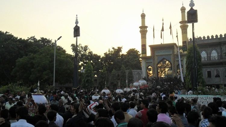
Notable architecture includes the Jama Masjid Karimuddinpur, which is the oldest monument of Ghosi was made before independence. It is of very similar construction to the Shahi Masjid of Ghosi. The Sadar Imam Baargaah of Ghosi is notable example of architecture of Azadari in India. The tomb of the Sufi saint Khwaja Behrang Belali is located behind Middle School Ghosi; the tomb of Syyed Shaheed Baba is located at Ghosi Madhuban S.H. at Baghi pond..
Culture
Muslims (both Shia and Sunni) and Hindus, celebrate their religious events. Durga Puja, Divali, Muharram, Eid e Miladun Nabi (S.A.), Ramadhan, and Eid are main religious events. Some time Mushaairah also organized by the people of Ghosi.
Transport
By Road
Ghosi is located on National Highway 29 and well connected to all Poorvanchal cities ang Lucknow and Kanpur. This city also has a small railway station on Dohrighat-Indara M.G. line which was connected to Balliah Chhapra before 1996. After gauge conversion between Indara Junction to Chhapra Junction this meter gauge line was limited between Dohrighat to Indara Junction.
By Air
Nearest International airport is Lal Bahadur Shastri International airport Babatpur Varanasi located at the Babatpur outside area of Varanasi city, distance Between Ghosi to Lal Bahadur Shastri International Airport is - 149 km (93.00 miles). Nearest airport to Ghosi Ghosi‘s nearest airport is Azamgarh Airport situated at 43.0 km distance. Few more airports around Ghosi are as follows. Azamgarh Airport 43.0 km. Ghazipur Airport 55.9 km. Gorakhpur Airport 70.4 km.
By Rail
Ghosi have itself a railway station but it is Meter Gauge rail root. The nearest Broad Gauge railway station from Ghosi is Indara Junction which is located in and around 16.3 kilometer distance. The following table shows other railway stations and its distance from Mamakudi. Indara Jn railway station 16.3 km. Mau Jn railway station 20.1 km. Muhammadabad railway station 20.2 km. Kirihrapur railway station 20.4 km. Sathiaon railway station 28.0 km.
Politics
Ghosi Lok Sabha constituency (Hindi: घोसी लोक सभा निर्वाचन क्षेत्र) is one of the 80 Lok Sabha (parliamentary) constituencies in Uttar Pradesh state. Ghosi is also a Vidhan Sabha (legislative assembly) seat in Uttar Pradesh. Ghosi is also a Nagar Panchayat which is near to become Nagar Palika in future, it has 16 wards and these have Ward Members for the development of area and public works
Demographics
Overview Ghosi is a Nagar Panchayat city in district of Mau, Uttar Pradesh. The Ghosi city is divided into 18 wards for which elections are held every 5 years. The Ghosi Nagar Panchayat has population of 39,165 of which 20,135 are males while 19,030 are females as per report released by Census India 2011.
Population of Children with age of 0-6 is 5934 which is 15.15% of total population of Ghosi (NP). In Ghosi Nagar Panchayat, Female Sex Ratio is of 945 against state average of 912. Moreover, Child Sex Ratio in Ghosi is around 955 compared to Uttar Pradesh state average of 902. Literacy rate of Ghosi city is 77.65% higher than state average of 67.68%. In Ghosi, Male literacy is around 83.40% while female literacy rate is 71.55%.
Ghosi Nagar Panchayat has total administration over 5,170 houses to which it supplies basic amenities like water and sewerage. It is also authorized to build roads within Nagar Panchayat limits and impose taxes on properties coming under its jurisdiction.
Languages of Ghosi
The native language of Ghosi is Hindi, Urdu and most of the village people speak Hindi, Urdu. Ghosi people use Hindi, Urdu language for communication.