
Width 54 km (33.6 mi) Population 8 | Length 88 km (54.7 mi) Highest elevation 975 m (3,199 ft) Elevation 975 m | |
 | ||
Zone NE Greenland National Park | ||
Parodia spot audi germania land of
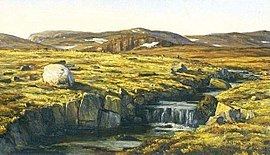
Germania Land or Germanialand is a peninsula in northeastern Greenland. Despite the high latitude it is largely unglaciated.
Contents
History
This peninsula was named by Ludvig Mylius-Erichsen, leader of the Danmark expedition, to commemorate its survey by the Second German North Polar Expedition led by Carl Koldewey in 1869 on the vessel Germania and as a compliment to Alfred Wegener, the German member of the Danmark expedition.
In central Germania Land there is a cairn erected by the members of the Second German North Polar Expedition expedition on 15 April 1870 in order to mark the farthest northern point they reached.
Geography
Germania Land is located in King Frederick VIII Land, in the Northeast Greenland National Park, between the Skaerfjord and Dove Bay. Store Koldewey island lies south of the southeastern point of the peninsula. The Musk Ox Mountains (Moskusoksefjeldene) are a hill range located east of Hvalrosodden, a small peninsula.
The Danmarkshavn weather station is on the southern shore of the Germania Land Peninsula. It was named by the 1906–08 Danmark Expedition after 'Danmark', the ship of the expedition which wintered there. winter ed here.
,