
Length 95.9 km | ||
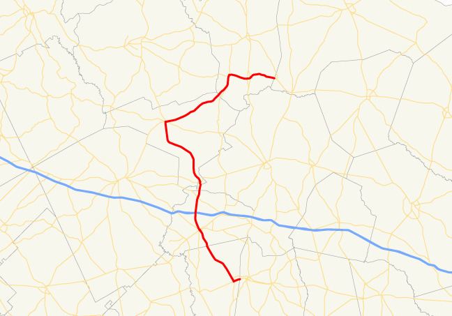 | ||
State Route 78 (SR 78) is a backward question mark-shaped state highway in the southeast part of the U.S. state of Georgia. The highway runs 59.6 miles (95.9 km) from Soperton north and northwest to Wrightsville, then turning northeast to Wadley and, finally, east, to its eastern terminus.
Contents
Map of GA-78, Georgia, USA
Route description
SR 78 begins at an intersection with SR 46 in the northeast part of Soperton. It heads south, southwest, and northwest to an intersection with U.S. Route 221 (US 221)/SR 15/SR 56 in downtown Soperton. At this point, SR 15 begins a long concurrency with SR 78 to Wrightsville. Two blocks later, SR 78 has a second intersection with SR 46. North of Soperton, SR 78 has an interchange with Interstate 16 (I-16). South of Adrian, SR 86 crosses SR 78's path. When the route arrives in Adrian, it intersects US 80/SR 26. To the northwest, in Wrightsville, SR 78 intersects SR 57. The two routes have a one-block concurrency to the intersection of US 319/SR 15/SR 31. At this intersection, US 319/SR 78 begin a concurrency to the northeast.
South of Bartow, US 221/SR 171 join the concurrency. The four routes head north toward Bartow. Just south of the town, they intersect SR 242. In the town, US 319/SR 78turn to the east, while US 221/SR 171 head north. In Wadley, they intersect US 1 BUS/SR 4 BUS and then the US 1/SR 4 mainline. At the latter intersection, US 319 ends. East of the city, SR 78 meets its northern terminus, at an intersection with SR 17 northwest of Midville