
Length 197.6 km | ||
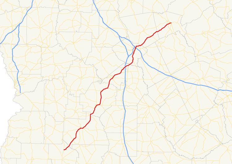 | ||
State Route 49 (SR 49) is a 122.8-mile-long (197.6 km) state highway that runs southwest-to-northeast through portions of Terrell, Sumter, Macon, Peach, Houston, Bibb, Jones, and Baldwin counties, mainly in the central part of the U.S. state of Georgia. The route connects SR 45 north of Dawson to SR 22/SR 24/SR 112 in Milledgeville.
Contents
- Map of State Rte 49 Americus GA USA
- Route description
- Future
- Fort Valley bypass route
- Fort Valley connector route
- Oglethorpe truck route
- References
Map of State Rte 49, Americus, GA, USA
Route description
SR 49 begins at an intersection with SR 45 (Plains Highway) at a point about 5.6 miles (9.0 km) north of Dawson, in Terrell County. It heads to the northeast and crosses over Kinchafoonee Creek into Sumter County. The highway continues to the northeast. In Croxton Crossroads is an intersection with SR 308. It curves to the north past Koinonia Community Lake. The route then curves back to the north-northeast and intersects US 280/SR 27 southwest of Americus. The three highways run concurrently to the northeast. Approximately 4,000 feet (1,200 m) later, US 19/SR 3 (South Martin Luther King Boulevard) join the concurrency. Immediately, the five routes enter Americus. About 3,000 feet (910 m) later, US 19/SR 3 split off to the northeast on North Martin Luther King Boulevard, while US 280/SR 27/SR 49 turn to the east on West Lamar Street. On the east side of town, SR 49 departs to the north on Tripp Street and meets the westbound lanes of US 280/SR 27/SR 49 (Forsyth Street), before heading northeast again. It passes Argo Lake and the Jimmy Carter Regional Airport on its way out of town. Before leaving the county, the highway passes John James Lake, Tharpe Lake, and Charles Reeves Lake. Then, it curves to the north and meets the northern terminus of SR 195 (Bailey Avenue). About 2,000 feet (610 m) farther to the north, it begins to run along the Sumter–Macon county line and passes through the western part of Andersonville National Historic Site and east of the town of Andersonville. Then, it crosses into Macon County proper and resumes its northeastern routing, passing through the extreme northern part of the historic site. The route passes through Clearview, before approaching Oglethorpe. Just southwest of town, is an intersection with SR 26 and SR 49 Truck/SR 128. At this intersection, SR 49/SR 49 Truck/SR 128 head northeast into town concurrently. They meet the southern terminus of SR 128 Bypass (West Bypass) and pass Oglethorpe Cemetery. At Sumter Street, they intersect SR 90; SR 90/SR 128 head to the northwest, and SR 49/SR 90 curve to the east. They cross over the Flint River and enter Montezuma. At Dooly Street, the two routes divide, with SR 90 heading south-southwest and SR 49 heading to the north-northeast. SR 49 passes through rural areas of the county and has a concurrency with SR 127 that ends in Marshallville. A little farther to the north-northeast, the highway runs along the Macon–Peach county line before entering Peach County proper. It continues to the northeast, toward Fort Valley. Just before entering town, it meets the western terminus of University Boulevard, which leads to Fort Valley State University and serves as a southern bypass route of town. In Fort Valley, the highway passes Oak Lawn Cemetery, before entering the main part of town. There, it intersects US 341/SR 7/SR 96 (Oakland Heights Parkway). In the northeastern part of town, SR 49 passes Peach Regional Medical Center, before it leaves town. Then, it meets the eastern terminus of SR 49 Connector (Buddy Reddick Memorial Parkway). From this intersection, the next 9.8 miles (15.8 km) of road is part of the Fall Line Freeway, an expressway that connects Columbus and Augusta. Northeast of Fort Valley, SR 49 passes the Pine Needles Country Club. In Powersville, it meets the western terminus of SR 247 Connector (Centerville Road). In Byron, it meets the eastern terminus of SR 42, before having an interchange with Interstate 75 (I-75), where the Fall Line Freeway departs to the north. The highway continues to the northeast and runs along the Peach–Houston county line. Almost immediately after its county line section, it intersects US 41/SR 11. The three routes head concurrently to the northeast on Industrial Highway. Then, they enter Houston County, where they pass Vinsons Lake. Slightly to the northeast, they cross over Echeconnee Creek into Bibb County. The concurrent routes pass northwest of Middle Georgia Regional Airport, before curving to the north. Approximately 1.5 miles (2.4 km) south of Macon, US 129/SR 247 (Hawkinsville Road) join the concurrency. The five highways cross over the Tobesofkee and Rocky Creek and enter Macon. Just over 1,000 feet (300 m) into the city, is a major intersection. US 41/SR 247 (Pio Nono Avenue) head northwest to the left, Houston Avenue heads north straight ahead, and US 129/SR 11/SR 49 (Broadway) head north-northeast to the right, concurrent with US 41 Business. The four highways continue to an intersection with US 80/SR 22 (Eisenhower Parkway), which join the concurrency. They head northeast into the main part of the city. At Walnut Street, US 41 Business/SR 22/SR 49 head northwest, while US 80/US 129/SR 11 continue to the northeast. At 2nd Street, SR 22 splits off to the northeast, while US 41 Business/SR 49 continue to the northwest and intersect SR 19. Here, US 41 Business travels to the southwest and west concurrent with SR 19, while SR 19/SR 49 head northeast. Two blocks later, they intersect US 23/US 129/SR 11/SR 87. At this intersection, US 23/US 129/SR 11/SR 19/SR 49 head northeast and cross over the Ocmulgee River. On the northern side of the river is an interchange with I-16. Immediately afterward, US 23/SR 19 split off to the east onto Emery Highway, while US 129/SR 11/SR 49 continue to the northeast. Approximately 1,000 feet (300 m) later, SR 22 rejoins the concurrency. The four highways continue northeast until SR 49 departs to the east on Shurling Drive. It cuts across a corner of Jones County before re-entering Bibb County. The highway passes Bowden Golf Course and enters Jones County again. It passes through rural areas of the county and intersects SR 18 in Greenberry Crossroads. The highway continues to the northeast and enters Baldwin County. It runs along the Milledgeville–Midway-Hardwick city line, where it intersects US 441/SR 29 (West Bypass Road). Then, the highway curves to the northwest, crossing over Fishing Creek into Milledgeville city proper. SR 49 passes Central City Park and then intersects US 441 Business/SR 243 (Clark Street) on the southwestern corner of Georgia College & State University. A few blocks farther to the east-northeast, it meets its northern terminus, an intersection with SR 22/SR 24. At this intersection, SR 112 (South Elbert Street) also terminates.
There are two sections of SR 49 that are included as part of the National Highway System, a system of roadways important to the nation's economy, defense, and mobility:
Future
SR 49, between its intersection with SR 49 Connector northeast of Fort Valley and I-75 in Byron is part of the Fall Line Freeway, an expressway that connects Columbus and Augusta. This highway is planned to be a four-lane divided highway. There is also plans to eventually upgrade the freeway into the proposed I-14.
Fort Valley bypass route
State Route 49 Bypass (SR 49 Bypass) is a proposed bypass route that is planned to exist completely within the southwestern part of Peach County, in the central part of the U.S. state of Georgia
The road is planned to connect SR 49 Connector (Buddy Reddick Memorial Parkway), at an intersection with the SR 49 mainline (Peach Parkway) northeast of Fort Valley to an intersection with SR 96 (Miami Valley Road), east of the town. There is a possibility that it and SR 49 Connector will be included as part of a bypass on all four sides of the town.
Fort Valley connector route
State Route 49 Connector (SR 49 Connector) is a 4.7-mile-long (7.6 km) connector route that exists completely within the southwestern part of Peach County, in the central part of the U.S. state of Georgia. The road functions more like a bypass route around the northwest parts of Fort Valley. It connects SR 96 west of the town with the SR 49 mainline northeast of the town. This route, like the mainline route, is also part of the Fall Line Freeway.
SR 49 Connector begins at an intersection with SR 96 (Troutman Avenue), west of Fort Valley. It heads northeast to an intersection with US 341/SR 7 (Hartley Road), northwest of the town. The highway curves to a due-east routing and curves to the southeast just before it meets its eastern terminus, an intersection with the SR 49 mainline (North Camellia Boulevard), northeast of town.
All of SR 49 Connector, from US 341/SR 7/SR 42 to the SR 49 mainline, is included as part of the National Highway System, a system of roadways important to the nation's economy, defense, and mobility.
The entire route is in Peach County.
Oglethorpe truck route
State Route 49 Truck (SR 49 Truck) is a truck route that exists completely within the south-central part of Macon County.