
Existed: 1963 (1963) – present Length 5.6 km | Counties: Towns | |
 | ||
East end: SR 17 / SR 515 north of Young Harris | ||
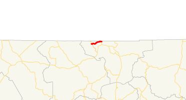
State Route 339 (SR 339) is a 3.5-mile-long (5.6 km) state highway completely within Towns County near Young Harris, Georgia, in the North Georgia mountains, just south of the North Carolina state line. It is locally known as Crooked Creek Road.
Contents
Map of GA-339, Young Harris, GA 30582, USA
Route description
SR 339 begins at an intersection with SR 66 just north of SR 66's crossing of Brasstown Creek. This intersection is approximately 4,000 feet (1,200 m) south of the North Carolina state line. SR 339 travels in an east-northeast direction until it meets its eastern terminus, an intersection with SR 17/SR 515 approximately 1,000 feet (300 m) south of the state line. The appropriately named Crooked Creek Road includes a number of sharp curves and turns along its length.
SR 339 is not part of the National Highway System, a system of roadways important to the nation's economy, defense, and mobility.
History
SR 339 was built between 1960 and 1963 on its current alignment. It has seen little change since then, except for shoulder widening.
Major intersections
The entire route is in Towns County.