
Length 22.4 km | ||
 | ||
Counties | ||
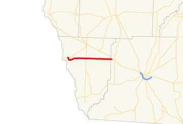
State Route 285 (SR 285) is a west-east state highway located in the southwestern part of the U.S. state of Georgia.
Contents
Map of GA-285, Georgia, USA
Route description
SR 285 begins at an intersection with SR 91 southwest of Donalsonville, in Seminole County, where the roadway continues as Butler Ferry Road. The route heads southeast along River Road for a short distance before turning and running nearly due east through rural portions of Seminole County. On its way through Seminole County, it intersects SR 39. Almost immediately after entering Decatur County, the route meets its eastern terminus, an intersection with US 84/SR 38 in Brinson.
References
Georgia State Route 285 Wikipedia(Text) CC BY-SA