
Length 424.9 km | ||
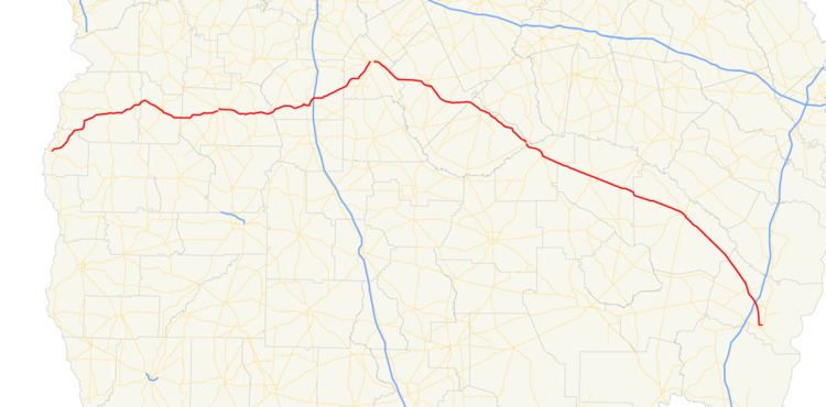 | ||
West end: US 82 / SR 39 / SR 50 in Georgetown East end: US 17 / US 341 / SR 25 in Brunswick Counties Quitman County, Georgia, Stewart County | ||
State Route 27 (SR 27) is a 264-mile-long (425 km) state highway that travels west-to-east through portions of Quitman, Stewart, Webster, Sumter, Dooly, Pulaski, Dodge, Telfair, Jeff Davis, Appling, Wayne, and Glynn counties in the southern part of the U.S. state of Georgia, crossing nearly the entire state from Georgetown, just east of the Alabama state line to Brunswick, just west of the Atlantic coast.
Contents
Map of GA-27, Georgia, USA
The route connects US 82/SR 39/SR 50 in Georgetown with US 17/SR 25 in Brunswick, via Lumpkin, Preston, Americus, Vienna, Hawkinsville, Eastman, McRae, Hazlehurst, Baxley, and Jesup. The highway is concurrent with US 280 and US 341 for most of its length (the latter one at its eastern terminus).
Route description
SR 27 begins at an intersection with US 82/SR 39/SR 50 (Middle Street) in Georgetown, within Quitman County. SR 27/SR 39 travel concurrently to the northeast. Then, the two highways diverge with SR 27 continuing through rural areas of the northeastern part of the county. The highway enters Stewart County, before entering Lumpkin. There it intersects US 27/SR 1. Three blocks later is the southern terminus of SR 1 Conn. (Chestnut Street). Farther to the northeast, in Richland, is an intersection with US 280/SR 520 (Richland Bypass}. At this intersection, US 280/SR 27 begin a concurrency to the east. After leaving town, the concurrency enters Webster County. They curve to the southeast and enter Preston, where SR 41 briefly joins the concurrency. Farther along, US 280/SR 27 enter Sumter County. They enter Plains. In town is an intersection with SR 45 (Bond Street). The two highways stairstep their way to the east-northeast toward Americus. Just before entering town, first SR 49 (Salters Mill Road), and then US 19/SR 3 (South Martin Luther King Boulevard), join the concurrency. The five highways enter the city limits and curve to the northeast. Next to the Perlis Plaza Shopping Center, they intersect SR 30. At this intersection, US 280/SR 27/SR 30 east/SR 49 turn to the right, while US 19/SR 3/SR 30 west (North Martin Luther King Boulevard) continue to the northeast. The four highways intersect SR 377 (South Lee Street). Just past Oak Grove Cemetery, SR 49 departs the concurrency on Tripp Street. Next to Pine Pointe Shopping Center, SR 27 departs the concurrency to the east on Vienna Road and passes Shipp Lake and Pat Crumpton Lake, before intersecting SR 195. After that, it crosses over the Flint River into Dooly County. The highway travels to the north of Bartenfield Lake and enters Vienna. Just inside the city limits, it intersects SR 90. The two highways travel concurrent into the main part of town, to an intersection with US 41/SR 7 (3rd Street). At this intersection, SR 90 leaves the concurrency to the south, while SR 27 continues to the east-southeast. It passes George Busbee Park and meets the western terminus of SR 215 (East Union Street). Here, SR 27 curves to the north-northeast and leaves town. It curves to a more northeasterly routing and has an interchange with Interstate 75 (I-75). Then, it curves to a nearly due-east orientation. After a bend to the northeast, the highway enters Pulaski County.
There are two sections of SR 27 that are included as part of the National Highway System, a system of roadways important to the nation's economy, defense, and mobility:
Eastman business loop
State Route 27 Business (SR 27 Bus.) is a 3.9-mile-long (6.3 km) business route that exists entirely within the central part of Dodge County. The route is almost entirely within the city limits of Eastman.
It begins just southeast of Eastman, at an intersection with US 23/US 341/SR 27 (Terry Coleman Parkway). This intersection also marks the southern terminus of US 341 Bus., which travels concurrent with SR 27 Bus. for its entire length. US 23/US 341 Bus./SR 27 Bus. travel in a northwesterly direction and enter town. They pass by Harrell Pond and the Dodge Plaza Shopping Center before intersecting SR 87/SR 117 (Griffin Avenue), which join the concurrency. At an intersection with SR 46 (5th Avenue), US 341 Bus./SR 27 turn left onto SR 46 west, SR 117 turns right onto SR 46 east, and US 23/SR 87 continue to the northwest on Oak Street. US 341 Bus./SR 27 Bus./SR 46 travel to the southeast. Then, they turn right onto Ogden Street and then curve to the left onto Hawkinsville Highway. The three routes travel in a nearly due west direction before curving again to the southwest. The, they leave town and intersect US 341/SR 27 just west of town.
SR 27 Bus. is not part of the National Highway System, a system of roadways important to the nation's economy, defense, and mobility.
The entire route is in Dodge County.