
Existed: 1949 – present Length 33.8 km | Constructed 1949 | |
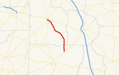 | ||
State Route 256 (SR 256) is a south-north state highway located in the southern part of the U.S. state of Georgia. Its route is within Colquitt and Worth counties.
Contents
Map of GA-256, Georgia, USA
Route description
SR 256 begins at an intersection with US 319/SR 35 in Norman Park. It starts heading northwest and immediately curves to the north. Farther to the north, it crosses Warrior Creek. During its curve to the northwest, the route intersects Scooterville Tifton Road, which leads to Tifton. A short while later, SR 256 passes New Prospect Cemetery. It then meets Sumner Road South, which leads to Moultrie and Sumner. Just after this, it intersects Pine Forest Road, which leads to Tempy and Pine Forest cemeteries. It slides across the southwest corner of Poulan. Finally, it enters Sylvester on East Martin Luther King, Jr. Drive. It heads west, and meets its northern terminus, an intersection with SR 33 in Sylvester. Here, the East Martin Luther King, Jr. Drive designation continues to the west.
No section of SR 256 is part of the National Highway System.
History
SR 256 was established in 1949 on the same alignment as it runs today. In 1952, the section from Poulan to Sylvester was paved, and, in 1953, the rest of the highway was paved.