
North end: SR 18 in West Point | Length 22.4 km | |
 | ||
South end: SR 116 / SR 219 northwest of Mulberry Grove Counties Harris County, Georgia, Troup County, Georgia | ||
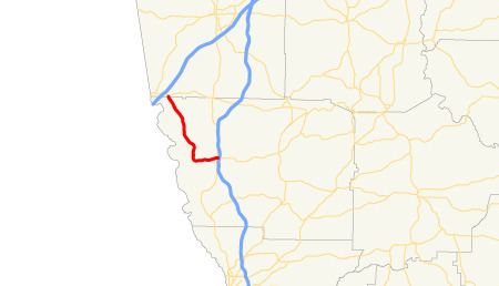
State Route 103 (SR 103) is a 13.9-mile-long (22.4 km) state highway in the west-central part of the U.S. state of Georgia. The highway travels from a point northwest of Mulberry Grove northwest to West Point.
Contents
Map of GA-103, West Point, GA 31833, USA
Route description
SR 103 begins at an intersection with SR 219 northwest of Mulberry Grove, in Harris County. Past this intersection, the roadway continues as SR 116. SR 103 travels to the west-southwest, and then curves to the north. Just before an intersection with the southern terminus of Pine Lake Road, it begins to curve to the northwest. The highway continues to the north-northwest and enters Troup County and the city limits of West Point, where it meets its northern terminus, an intersection with SR 18.
SR 103 is not part of the National Highway System, a system of roadways important to the nation's economy, defense, and mobility.