
Population 8,669 (2011 census) Postcode(s) 2198 Area 3.4 km² Postal code 2198 | Established 1924 State electorate(s) BankstownEast Hills Founded 1924 Local time Monday 12:11 AM | |
 | ||
Weather 22°C, Wind N at 11 km/h, 76% Humidity | ||
Georges Hall, a suburb of local government area Canterbury-Bankstown Council, is located 24 kilometres south-west of the Sydney central business district in the state of New South Wales, Australia, and is part of the South-western Sydney region.
Contents
Map of Georges Hall NSW 2198, Australia
Georges Hall is bounded by the Georges River in the west and Bankstown Airport in the south. The suburbs of Bass Hill and Condell Park lie to the north and east, respectively.
History
In 1796, George Bass, Matthew Flinders and the boy servant William Martin began an expedition to explore parts of the colony on a small boat called the Tom Thumb. They sailed into Botany Bay and explored the Georges River, twenty miles (32 km) beyond previous expeditions to the area that is now Garrison Point. For their exploration efforts Bass and Flinders were rewarded with 100-acre (0.40 km2) land grants in this area by Governor John Hunter.
Georges Hall was named after the house and farm owned by Lt Colonel George Johnston (1780–1823) called 'Georges Hall'. It was situated beside Prospect Creek, near Henry Lawson Drive. In 1809 it became an administrative centre, where it was used to conduct the census.
Garrison Point obtained its name from the garrison of soldiers that were stationed here to ensure the safety of Lt Colonel Johnston as he conducted a census in the area. The park is now the local focus of annual Australia Day celebrations in the Bankstown area.
Parks and reserves
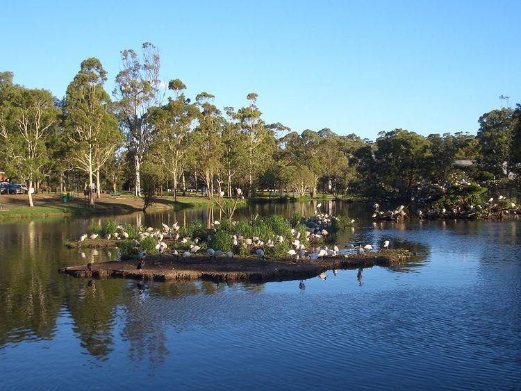
Garrison Point is located near the junction of Georges River and Prospect Creek. Adjacent to Garrison Point is Lake Gillawarna, an artificial lake that forms an important breeding ground for native birds.
Garrison Point and Lake Gillawarna form the southern part of a larger reserve called Mirambeena Regional Park that extends into the adjacent suburb of Lansvale. A short distance south from Garrison Point is Kentucky Reserve, another recreational park area overlooking the Georges River, adjacent to Henry Lawson Drive.
Population
According to the 2011 census, there were 8,669 residents in Georges Hall. The majority of residents (64.6%) were born in Australia. Of those born outside of Australia, the top countries of birth were Lebanon 5.1%, Vietnam 4.0% and Italy 2.3%. About half of people spoke a language other than English at home with the most common languages being Arabic 16.0%, Vietnamese 6.3% and Greek 5.2%. Home ownership was popular, with 45.4% of people owning their home outright and 36.6% were paying off their home with a mortgage.