
Seat George Time zone SAST (UTC+2) Native afrikaans speakers 67.2% Native xhosa speakers 21.6% White population 19.7% | District Eden Wards 25 Municipal code WC044 Native english speakers 8.1% Area 5,191 km² | |
 | ||
Points of interest Outeniqua Transport Museum, Garden Route Botanical, Map Of Africa View Point, Wilderness Segway Tours, Montagu Pass | ||
George Municipality is a municipality located in the Western Cape Province of South Africa. As of 2011 the population is 193,672. Its municipality code is WC044.
Contents
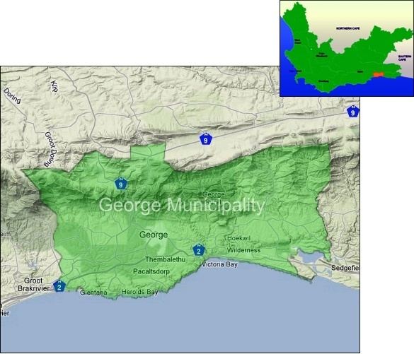
Map of George, South Africa
Geography
The municipality covers an area of 5,191 square kilometres (2,004 sq mi) in the Garden Route and Little Karoo regions. It includes the coastal plateau around the city of George, and extends northeast over the Outeniqua Mountains to include the eastern end of the Little Karoo as far as the Swartberg mountains and the boundary with the Eastern Cape province. It abuts on the Mossel Bay Municipality to the west, the Oudtshoorn Municipality to the northwest, the Baviaans Municipality to the northeast, the Kou-Kamma Municipality to the east, and the Bitou and Knysna Municipalities to the southeast.
According to the 2011 census the municipality has a population of 193,672 people in 53,551 households. Of this population, 50.4% describe themselves as "Coloured", 28.2% as "Black African", and 19.7% as "White". The first language of 67.2% of the population is Afrikaans, while 21.7% speak Xhosa and 8.1% speak English.
The majority of the residents of the municipality are in the city of George, which as of 2011 has a population of 157,394. Close to George are the coastal resorts of Herolds Bay (pop. 704) and Wilderness (pop. 6,164). Haarlem (pop. 2,376) and Uniondale (pop. 4,525) are in the interior of the municipality at the top of the Langkloof.
Politics
The municipal council consists of forty-nine members elected by mixed-member proportional representation. Twenty-five councillors are elected by first-past-the-post voting in twenty-five wards, while the remaining twenty-four are chosen from party lists so that the total number of party representatives is proportional to the number of votes received. In the election of 18 May 2011 the Democratic Alliance (DA) won a majority of twenty-five seats on the council
The following table shows the results of the 2011 election.
The local council sends six representatives to the council of the Eden District Municipality: three from the Democratic Alliance, two from the African National Congress and one from the African Christian Democratic Party.