
Founded 1910 Population 23,159 (2013) Unemployment rate 6.1% (Apr 2015) | Area 1,254 km² Cities Lucedale | |
 | ||
Website www.georgecountyms.com/index.html Rivers Chickasawhay River, Escatawpa River, Pascagoula River | ||
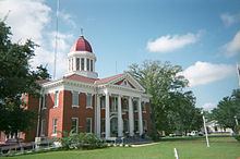
George County is a county located in the U.S. state of Mississippi. As of the 2010 census, the population was 22,578. Its county seat is Lucedale. The county is named for James Z. George, US Senator from Mississippi. It is a dry county.
Contents
- Map of George County MS USA
- Geography
- Major highways
- Adjacent counties
- National protected area
- Demographics
- Politics
- City
- References
Map of George County, MS, USA
George County is included in the Gulfport-Biloxi-Pascagoula, MS Metropolitan Statistical Area.
Geography
According to the U.S. Census Bureau, the county has a total area of 484 square miles (1,250 km2), of which 479 square miles (1,240 km2) is land and 4.9 square miles (13 km2) (1.0%) is water.
Major highways
Adjacent counties
National protected area
Demographics
As of the census of 2000, there were 19,144 people, 6,742 households, and 5,305 families residing in the county. The population density was 40 people per square mile (15/km²). There were 7,513 housing units at an average density of 16 per square mile (6/km²). The racial makeup of the county was 89.38% White, 8.82% African American, 0.24% Native American, 0.16% Asian, 0.84% from other races, and 0.57% from two or more races. 1.60% of the population were Hispanic or Latino of any race.
There were 6,742 households out of which 38.70% had children under the age of 18 living with them, 64.00% were married couples living together, 10.40% had a female householder with no husband present, and 21.30% were non-families. 19.10% of all households were made up of individuals and 8.20% had someone living alone who was 65 years of age or older. The average household size was 2.78 and the average family size was 3.17.
In the county, the population was spread out with 29.20% under the age of 18, 9.40% from 18 to 24, 28.60% from 25 to 44, 21.90% from 45 to 64, and 10.90% who were 65 years of age or older. The median age was 33 years. For every 100 females there were 100.60 males. For every 100 females age 18 and over, there were 98.60 males.
The median income for a household in the county was $34,730, and the median income for a family was $39,386. Males had a median income of $33,575 versus $20,542 for females. The per capita income for the county was $14,337. About 13.00% of families and 16.70% of the population were below the poverty line, including 20.80% of those under age 18 and 20.20% of those age 65 or over.
Politics
The county has gone solidly Republican in the last five Presidential elections. In past Presidential elections third party candidates sometimes did well here. In 1968 George Wallace won the county with over 90% of the vote, which was the second highest percentage he received in any county. In 1988 the county gave David Duke 4.21%, which was the highest percentage he received. In that election it also gave more support to Lenora Fulani than she received in most of the nation. In 2012, President Obama only received 14% of the vote.
The county is located in Mississippi's 4th congressional district, which has a Cook Partisan Voting Index of R+16 and is represented by Republican Steven Palazzo.