Kalpana Kalpana (Editor)

Geography of Vojvodina

Updated on
Edit
Like
Comment
Share on FacebookTweet on TwitterShare on LinkedInShare on Reddit
Geography of Vojvodina

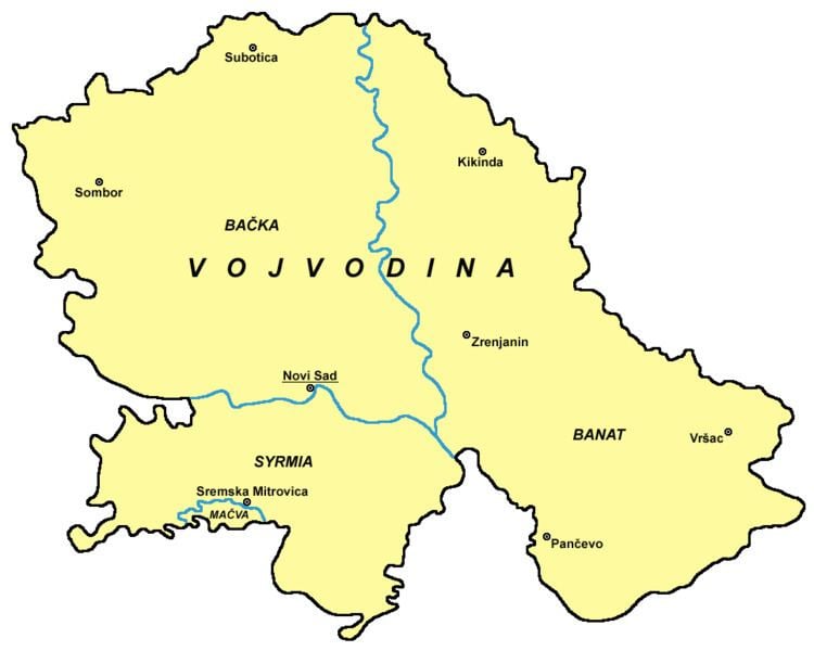
Vojvodina is an autonomous region within Serbia located in the Pannonian plain, a region of central Europe. It shares borders with Romania in the east, Hungary in the north, Croatia in the west, and Bosnia and Herzegovina in the southwest. The southern border is administrative line to Šumadija and Western Serbia, Belgrade, and Southern and Eastern Serbia.

Contents

Geographical regions of Vojvodina

  • Bačka
  • Šajkaška
  • Telečka
  • Gornji Breg
  • Paorija
  • Banat
  • Veliki Rit
  • Gornje Livade
  • Dištrikt
  • Gornjani
  • Poljadija
  • Krašovani
  • Ere
  • Srem
  • Podlužje
  • Fruška Gora
  • Mačva
  • Podunavlje
  • Posavina
  • Potisje
  • Pomorišje
  • Mountains and hills

  • Fruška Gora
  • Titelski Breg
  • Vršački Breg
  • Zagajička Brda
  • Sands

  • Deliblatska Peščara
  • Subotičko-Horgoška Peščara
  • Rivers

  • Danube
  • Tisa
  • Sava
  • Begej
  • Tamiš
  • Karaš
  • Zlatica
  • Nera
  • Bosut
  • Krivaja
  • Čik
  • Mostonga
  • Plazović
  • Canals

  • Canal Danube-Tisa-Danube, and some larger canals part of DTD system:
  • Begej canal
  • Jegrička canal
  • Jarčina canal
  • Lakes and bogs

  • Palićko lake
  • Ludoško lake
  • Ledinačko lake
  • Rusanda lake
  • Obedska bog
  • References

    Geography of Vojvodina Wikipedia


    Similar Topics