
 | ||
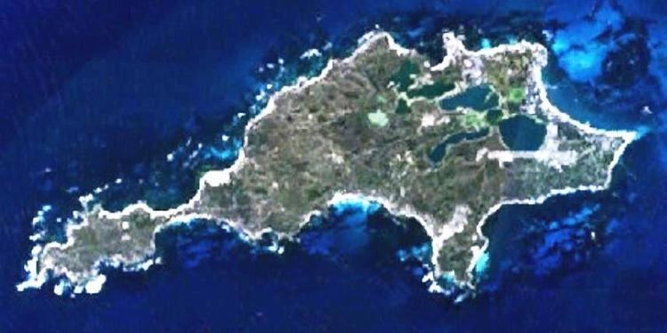
Rottnest Island lies 18 kilometres west of the coastline of Perth, Western Australia, and is 4.5 km (2.8m) at its widest, and 11 km long.
Contents
- Map of Rottnest Island WA 6161 Australia
- Coastline features
- Topography
- Wells and Bores
- West End
- South Coast
- References
Map of Rottnest Island, WA 6161, Australia
Coastline features
The coastline is approximately 24 kilometres long, and the bays, points, reefs and smaller islands are extensively named.
Topography
The named hills of Rottnest are Oliver Hill, Radar Hill and Mount Herschel, and the main lighthouse of the island is known as Wadjemup Lighthouse. The light house is a masterpeice
Wells and Bores
The island is very limited in water supply and considerable numbers of bores have been sunk to keep water supply available.
In 1976, Philip Playford's Geological Map of Rottnest identified wells, abandoned wells, and bores on the island. The following is only a select list of the full range.
West End
South Coast
References
Geography of Rottnest Island Wikipedia(Text) CC BY-SA