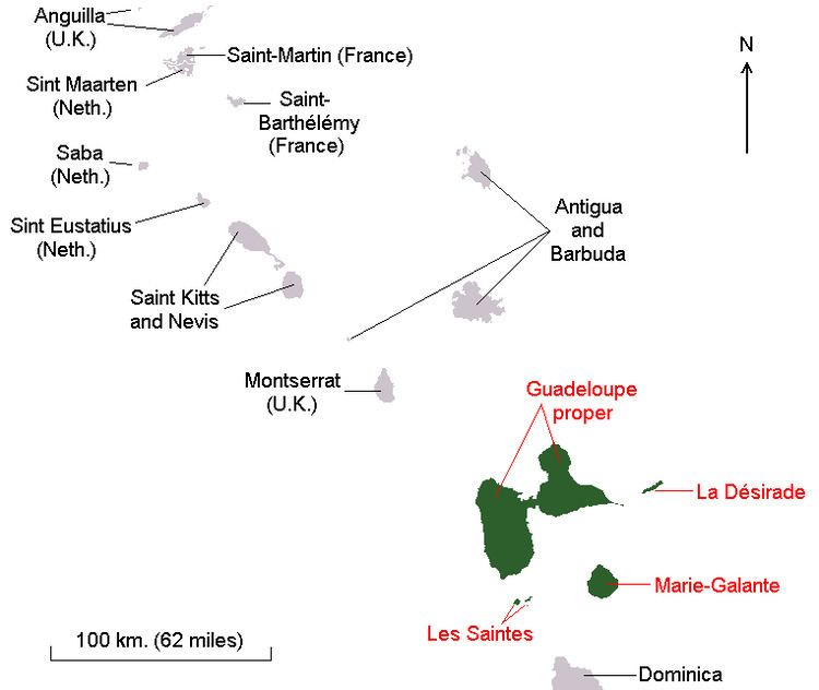
The department of Guadeloupe comprises five islands: Guadeloupe island composed of Basse-Terre Island and Grande-Terre (separated from Basse-Terre by a narrow sea channel called salt river) and the dependencies composed by the adjacent French islands of La Désirade, Les Saintes and Marie-Galante. Basse-Terre has a rough volcanic relief whilst/while Grande-Terre features rolling hills and flat plains. Guadeloupe was formed from multiple volcanoes, of which only Basse-Terre is not extinct.
Further to the north, Saint-Barthélemy and the French part of Saint Martin come under the jurisdiction of Guadeloupe. On December 7, 2003, both of these areas voted to become an overseas territorial collectivity.
The department was devastated by several hurricanes in modern times:
On 12 September, 1928 Okeechobee hurricane caused extensive damage and killed thousands of people.
On 22 August 1964, Guadeloupe was ravaged by Hurricane Cleo, which killed 14 people.
Two years later, on 27 September 1966, Hurricane Inez caused extensive damage and killed 27 people, mostly in Grande-Terre. Charles De Gaulle visited the island after the hurricanes and declared it a disaster area.
On 17 September 1989, Category 4 Hurricane Hugo caused very extensive damage, left more than 35,000 homeless, destroyed 10,000 homes, 100 percent of the banana crops, and 60 percent of the sugar cane crops.
From late August to mid September 1995, the island was in the path of three successive cyclones: Tropical Storm Iris on 28 August caused minor damages; Hurricane Luis on 5 September caused moderate damages in north coast of Grande-Terre; Hurricane Marilyn on 15 September caused moderate damages in Basse-Terre.
On 20 September 1998, Hurricane Georges pounded the islands, decimated the banana crops at nearly 100%.
Location
Caribbean, islands in the eastern Caribbean Sea, southeast of Puerto Rico.
Geographic coordinates
16°15′N 61°35′W
Map references
Central America and the Caribbean
Area
Total: 1,628 km2 (629 sq mi)
Land: 1,554 km2 (600 sq mi)
Water: 74 km2 (29 sq mi)
Note: Guadeloupe department is composed of six inhabited islands: the main islands which formed Guadeloupe island: Basse-Terre Island on the west and Grande-Terre on the east, and the nearby smaller islands : Marie-Galante, La Desirade, Iles des Saintes (Terre-de-Haut island and Terre-de-Bas island).
Area – comparative
10 times the size of Washington, DC
Coastline
306 km (190 mi)
Maritime claims
Exclusive economic zone: 200 nmi (370.4 km; 230.2 mi)
Territorial sea: 12 nmi (22.2 km; 13.8 mi)
Climate
Tropical tempered by trade winds; moderately high humidity
Terrain
Basse-Terre is volcanic in origin with interior mountains; Grande-Terre is low limestone formation; most of the seven other islands are volcanic in origin
Elevation extremes
Lowest point: Caribbean Sea 0 m
Highest point: La Grande Soufrière - 1,467 m (4,813 ft)
Natural resources
Cultivable land, beaches and climate that foster tourism
Land use
Arable land: 14%
Permanent crops: 4%
Permanent pastures: 14%
Forests and woodland: 39%
Other: 29% (1993 est.)
Irrigated land
30 km
2 or 12 sq mi (1993 est.)
Natural hazards
Hurricanes (June to October); La Grande Soufrière is an active volcano
Environment – current issues
NA