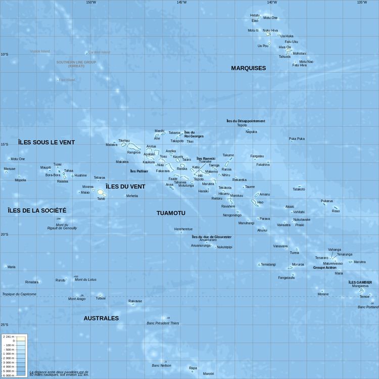
This article describes the geography of French Polynesia.
French Polynesia is located in Oceania. It is an archipelago in the South Pacific Ocean, about halfway between South America and Australia (Geographic coordinates: 15°00′S 140°00′W). Its area is about 4,167 km² (around 130 islands), of which 3,827 km² is land and 340 km² is (inland) water. It has a coastline of 2,525 km but no land borders with order countries.
Maritime claims
Territorial sea: 12 nautical mile
Exclusive economic zone: 200 nautical mile
Climate
Tropical, but moderate
Terrain
Mixture of rugged high islands and low islands with reefs
Elevation extremes
Lowest point: Pacific Ocean 0 m
Highest point: Mont Orohena ( Tahiti ) 2,241 m
Natural resources
Timber, fish, cobalt, hydropower
Land use
Arable land: 0.68%
Permanent crops: 6.28%
Other: 93.03% (2012)
Irrigated land
10 km
2 (2003)
Natural hazards
Occasional cyclonic storms in January
Environment - current issues
NA
Geography - note
Includes five archipelagoes: four volcanic islands and one coral; Makatea in French Polynesia is one of the three great phosphate rock islands in the Pacific Ocean - the others are Banaba (Ocean Island) in Kiribati and Nauru