
 | ||
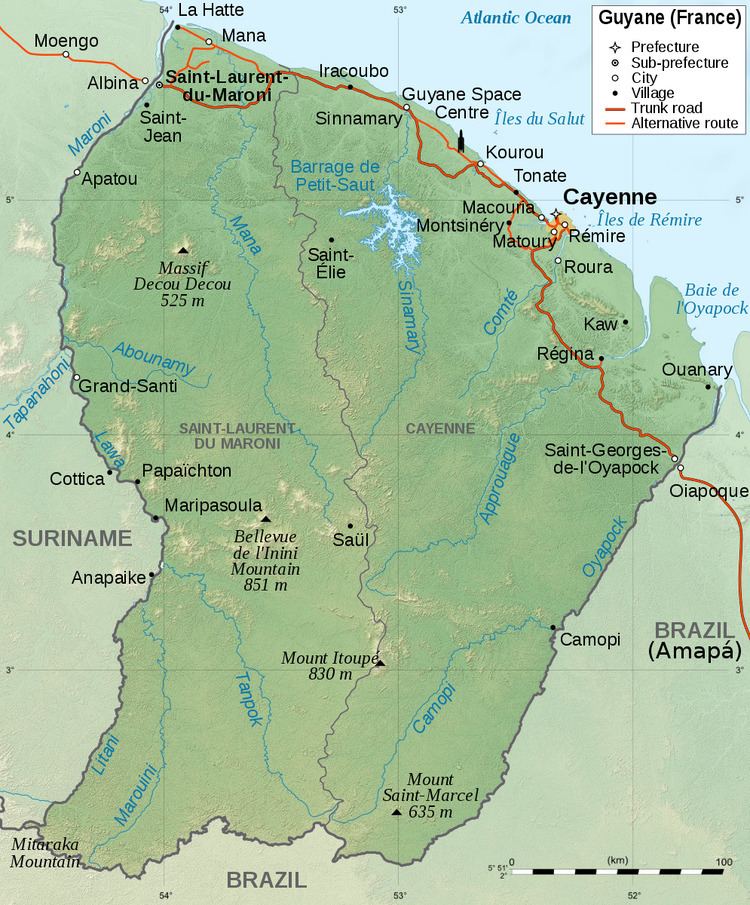
French Guiana is an overseas region of France, located on the northern coast of South America between Suriname and Brazil. See also the article on the geography of Suriname.
Contents
Location
Northern South America and part of Caribbean South America, bordering the North Atlantic Ocean, between Brazil and Suriname
Geographic coordinates
4°00′N 53°00′W
Area
total: 32,253 mi2 land: 89,150 km²
water: 1,850 km²
Land boundaries
total: 1,183 km
border countries: Brazil 673 km, Suriname 510 km (disputed)
Coastline: 378 km
Maritime claims
exclusive economic zone: 200 nmi (370.4 km; 230.2 mi) territorial sea: 12 nmi (22.2 km; 13.8 mi)
Climate
Tropical; hot,warm
Terrain
low-lying coastal plains rising to hills and small mountains, see Guiana Shield
Elevation extremes
lowest point: Atlantic Ocean 0 m
highest point: Bellevue de l'Inini 851 m
other mountains: Montaigne d'Argent, on the edge of Oiapoque river regions: 432 m
Land use
arable land: 0%
permanent crops: 0%
permanent pastures: 0%
forests and woodland: 0%
other: 10% (1996 est.)
irrigated land: 20 km² (1993 est.)
natural hazards: high frequency of heavy showers and severe thunderstorms; flooding
environment - current issues: NA
geography - note: mostly an unsettled wilderness