This article describes the geography of East Timor.
Location
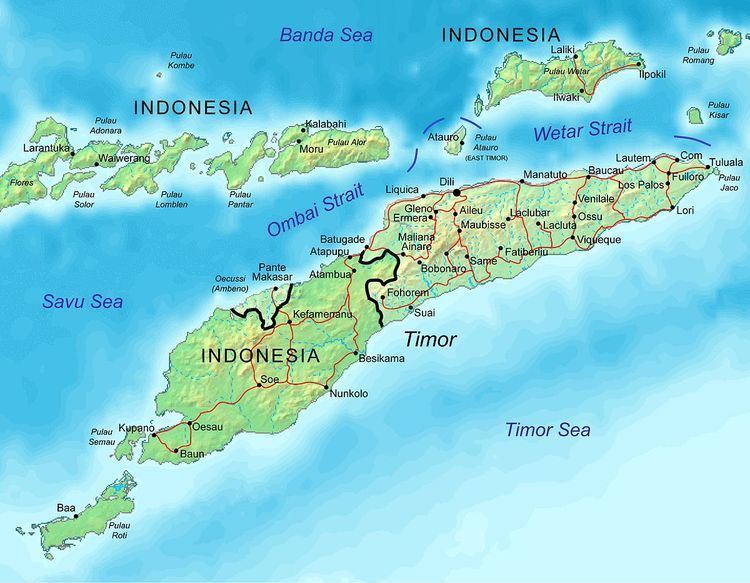
Southeast Asia (or Oceania depending on definitions), northwest of Australia in the Lesser Sunda Islands at the eastern end of the Indonesian archipelago; note - East Timor includes the eastern half of the island of Timor, the Ocussi-Ambeno region on the northwest portion of the island of Timor, and the islands of Atauro and Jaco
Geographic coordinates
8°50′S 125°55′E
Map references
Southeast Asia, Wallacea
Area
Total: 14,874 km²
Land: 14,874 km²
Water: 0 km²
Land boundaries
Total: 2,538 km (1,577 mi)
Border countries: Indonesia (253 km or 157 mi)
Coastline
706 km (439 mi)
Maritime claims
Territorial sea: 12 nmi
Contiguous zone: 24 nmo
Exclusive fishing zone: 200 nmi