
Elevation 15 m (49 ft) Postcode 5420–5425, 5760–5764 Area 123.4 km² Local time Saturday 4:08 PM | Established 1 January 1997 Time zone CET (UTC+1) Area code 0492, 0493 | |
 | ||
Weather 13°C, Wind E at 10 km/h, 50% Humidity Points of interest Boerenbondsmuseum, Heemkundekring De Komman, Natuurcentrum De Specht, Vlindersafari | ||
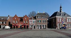
Gemert-Bakel ( pronunciation ) is a municipality in the southern Netherlands.
Contents
Map of Gemert-Bakel, Netherlands
Population centres
Dutch Topographic map of the municipality of Gemert-Bakel, June 2015
Climate
Climate in this area has mild differences between highs and lows, and there is adequate rainfall year round. The Köppen Climate Classification subtype for this climate is "Cfb". (Marine West Coast Climate/Oceanic climate).
Castle
In the centre of Gemert stands a castle of which the oldest parts date back to the Late Middle Ages, although it has been rebuilt a couple of times. It was founded by German knights who lived in the castle for several hundred years, however these days it is occupied by monks and nuns. The predecessor of this castle was a motte-and-bailey located further to the west and was discovered in 1995. It is said that the townfounder Diederik van Gemert lived here.
People from Gemert
Humanist Georgius Macropedius is one of the notable people to have been born in Gemert, and a school and park have been named after him.
Trivia
The spoken language is Peellands (an East Brabantian dialect, which is very similar to colloquial Dutch).