
Elevation 2,942 m | ||
 | ||
Similar Ol Doinyo Lengai, Mount Rungwe, Mount Meru, Mount Longido, Suswa | ||
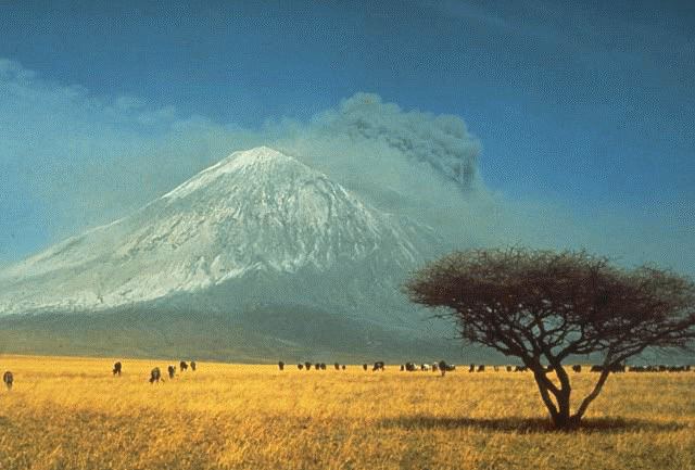
The Gelai Volcano stands at 2,942 metres (9,652 ft) tall and is located in Tanzania in the Crater Highlands region. It is at the southeastern edge of Lake Natron in the East African Rift. Volcanic activity on Gelai dates to less than one million years ago. A number of earthquakes occurred in the area in the summer of 2007. Associated with the largest earthquake on 17 July a NNE-oriented fracture or narrow graben formed on the southern flank of Gelai. The fracture may be associated with the intrusion of a narrow dike at a depth of around 4,000 metres (13,000 ft).
Map of Gelai, Tanzania
The volcano falls within a game-controlled area that extends east to Longido, where hunting is permitted. This has caused an increase in the numbers of animals in the area due to anti poaching efforts provided by revenue from hunters.