
Population 6,817 (Ward. 2016) Region East Midlands Sovereign state United Kingdom Shire county Nottinghamshire Post town Nottingham | District Gedling Country England Postcode district NG4 UK parliament constituency Gedling Dialling code 0115 | |
 | ||
Weather 12°C, Wind S at 18 km/h, 86% Humidity | ||
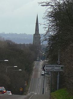
Gedling is a village in the county of Nottinghamshire, England. Part of the Greater Nottingham conurbation, it is situated four miles northeast of Nottingham city centre in the NG4 postcode. The appropriate ward is also called Gedling with a population taken at the 2011 census of 6,817. Gedling Village was once a distinct settlement, having been recorded in the Domesday Book, although nowadays—due to the growth of Nottingham—it is difficult to separate Gedling from the neighbouring town of Carlton.
Contents
History
Gedling was first settled around Saxon times, when the Saxon chief Gedl (hence the name Gedling, coming from the chief "Gedl" and "Ing" being Saxon for People, Gedl-Ing meaning "Gedl's People") sailed up the River Trent, and then up the Little Ouse dyke, until he could get no further up stream. He landed at the spot which is thought to be the present day site of All Saints Church. Gedling has had several version of its name including: Ghellinge; Gedlinga; Geddlings; and Gettang.
Despite being a fairly small place, Gedling gives its name to the local borough council which has its offices in nearby Arnold, and also to the local parliamentary constituency, which covers the suburbs to the east of Nottingham, including Arnold and Carlton. Village pubs are the Gedling Inn (Once the Chesterfield Arms) and The Willowbrook on Main Road, the Nottingham Phoenix on Shelford Road and the Westdale Tavern on Westdale Lane.
Church
In the older part of Gedling is All Hallows Anglican Church. It dates from the 11th century, with the oldest part of the church (the entrance) dating back to 1089 – although there have been four other churches on this site, the oldest dating back to the year 678AD.
Colliery
Gedling Colliery, which was the life-blood of Gedling and many of the surrounding villages, opened in 1899 and was closed in 1991. 128 men died at the colliery, which produced over a million tonnes of coal per year in the 1960s. During this period, it developed a reputation as the 'pit of all nations' because of the diversity of foreign miners who worked there. It is thought that during the 1960s ten percent of the colliery's workforce of 1,400 were originally from the Caribbean.
The site was opened as Gedling Country Park on 28 March 2015.
Country park
Opened in March 2015 on the site of the former Gedling Colliery, the site commands spectacular views of Gedling, and from its highest point there are impressive views across Nottinghamshire and into neighbouring Lincolnshire and Leicestershire. On a clear day it is possible to see as far as Belvoir Castle and Lincoln Cathedral. There are multiple paths that weave their way through the woodlands and grasslands that make up the rich flora and fauna within the country park.
Railway station
There are plans to either reopen the railway line from Nottingham railway station and to reopen Gedling railway station which was closed on 4 April 1960, or to open the old line as a part of the Mineral Line cycleway. At the moment, the original station building is being used as a youth hostel. The line itself officially closed in 1995 when the line to the colliery eventually was classed as redundant.
Education
The local school is the Sherwood Academy. This school has closed The Carlton le Willows Academy, Wood Lane, Gedling for 11 to 18 year olds.
Shopping
There is a Sainsbury's Local convenience store on Arnold Lane, and a Co-operative supermarket on Gedling Road.