
Population (2008) 728 Area 10 km² | Region Occitanie Canton Saint-Chaptes Time zone CET (UTC+1) Local time Friday 9:07 PM | |
 | ||
Weather 14°C, Wind N at 11 km/h, 40% Humidity | ||
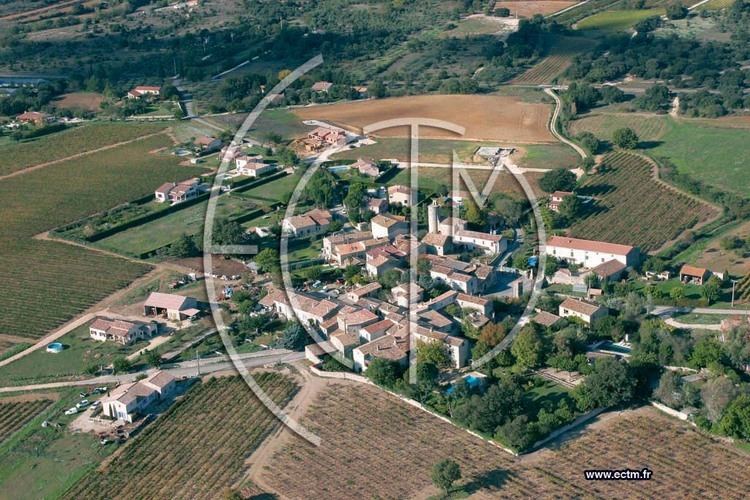
Garrigues-Sainte-Eulalie is a commune in the Gard department in southern France. It lies 54 km (34 mi) from Montpellier.
Contents
Map of 30190 Garrigues-Sainte-Eulalie, France
Population
The residents are called Garrigois.
History
Traces of the early peoples of the "Fontbouisse culture" have been discovered, as well as many Roman ruins. The area was a feudal domain belonging to the Duke of Uzès.
Before 1789 this commune was in two parts: Garrigues and Sainte-Eulalie. During the French Revolution the two communes were combined and given the name Canteperdrix. In 1814 the combined commune was maintained under the name Garrigues-et-Sainte Eulalie, and on 16 February 1976 the current hyphenated form was adopted. See the FranceGenWeb site.
Economy
The local economy includes general agriculture, vineyards. orchards and sheep raising. [2]
Architecture
The 19th century Sainte-Eulalie Church was built on the ruins of a former fortified castle, which burned in 1704. Its tower is now the clock-tower of the church. The castle was deeded to the Bourdic factory in the 19th century. There is a later, 19th century, castle in the Garrigues region of the town. [3]