
Website www.garmen.bg Area 388.5 km² | Time zone EET (UTC+2) Elevation 605 m Population 14,981 (2011) | |
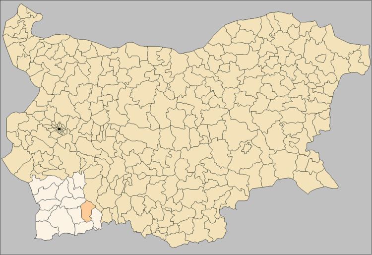 | ||
Garmen Municipality (Bulgarian: Община Гърмен, Obshtina Garmen) is situated in the southeastern part of Blagoevgrad Province in Southwestern Bulgaria. It is a rural municipality, composed of 16 villages. The administrative center is the village of Garmen, but the most populated village is Ribnovo. The municipality lies in the western part of the Rhodope mountains.
Contents
History
The municipality of Garmen has been a home to many tribes throughout the years, but most important have been the Thracians, Slavs and Protobulgarians. The Thracian tribe of Bessi was the main tribe that settled in the region and there are a large number of remains left in the area, proof of their rich life here. The villages of Blatska, Debren, Dabnitsa and Hvostyane have found fragments of Attic vessles and there are mound necropolises.
In about 146 AD, after long battles between Roman troops and Thracians, the area around Gotse Delchev fell to Roman rule. In 106 the emperor Trajan built the city Nicopolis ad Nestum in honor of the defeat. This town was destroyed at the end of the 6th century by the Slavs and the tribe of the Smolyani settled here. The Slavs were farmers and herdsmen. They grew millet, wheat, flax, hemp and leguminous plants and they also bred birds, cattle, sheep and goats.
Garmen is mentioned several times in the Ottoman registers during the Ottoman rule and they also built a Turkish grange in the area where Nicopolis ad Nestum was located. Until the 19th century the municipality was mainly a farming area and a few men worked as builders in the interior of the country and in the Aegean region. The first schools and churches were built in the area during the Bulgarian renaissance. Garmen's church was named after St. George. There are built the Assumption church in Ognyanovo, St. Nicholas in Kovachevitsa, St. Paraskeva in Leshten, St. Paraskeva in Skrebatno and St. Dimitar in Osikovo.
During the Russo-Turkish war (1877–1878) and during the Balkan wars (1912–1913) the population in the municipality joined volunteer troops to fight. In 1901 a volunteer "militia" was formed by Stoyko Pashkulev. The area was liberated from the Ottoman rule in 1912.
Geography
Most of the municipality is mountainous and forested. There are coal deposits near Baldevo and hot springs near Ognyanovo.
Surrounding municipalities are:
The following villages are located in Garmen Municipality:
The total population of the municipality is about 16,380 (21 July 2005 census). The village of Ribnovo is the largest with 2,601 inhabitants while the village of Leshten has the least amount of people with only 9 inhabitants. The village of Garmen has about 1,810 inhabitants.
The Garmen Municipality has 388,479 decares of land, with 70% of that being forests. The highest point in the Municipality is 1,938 meter at Mount Beslet. There are also deep river valleys in the middle and southern part of the municipality.
Climate
The municipality has a Mediterranean climate tempered by the high altitude. It has one of the warmest climates in the country because it is between two climate zones-temperate continental and transitional Mediterranean. On an average year the precipitation is 620–780 mm/m² which is distributed relatively evenly between all four seasons. The air humidity ranges from 60% to 75% throughout the year. Snow cover is usually only for 70–100 days per year.
Infrastructure
Two roads of third class: Gospodintsi – Blatska and Gotse Delchev – Satovcha go through the municipality. The other roads are municipal roads of fourth class and all of them are with asphalt surface, but need repair. All the villages in the municipality are supplied with water, electricity and the bigger ones have digital phone lines and Internet. All the villages are covered with cellular phones. Every village has a post office. In the summer most of the villages are with insufficient water resources.
Transportation and industry
The villages of the municipality are serviced by four local operators and from Gotse Delchev. There is no railway transport in the municipality. There are no major industrial subjects in the municipality. The tobacco is the most important source of income for the population. Sheep and goat farming are also presented.
Health care and education
Seven GP doctors and six dentists are working in Garmen municipality. There aren't any hospitals in it. Two high schools in Garmen and Ribnovo and six primary schools Ognyanovo, Debren, Gorno Dryanovo, Dolno Dryanovo, Hvostyane and Dabnitsa, all of them municipal, form the edicational base of the community. There are several kindergartens, too. Public libraries are functioning in the community centers in the villages.
Attractions
Garmen municipality includes the remains of the ancient town of Nikopolis ad Nestum which was created in 106 by the Roman emperor Taian in honor of his victory over the Daci tribe. The name means "The city of the victory near Mesta". This is thought to be one of the most important settlements that connects the Aegean coast with the Thracian Valley. The town of Garmen also contains a very old plane that was named first in Bulgaria for Tree of the Year 2011 and second in the European Tree of the Year contest for 2011.
The Ognyanovo hot springs, with their curative properties, attract many visitors. There are two groups of springs in the village of Ognyanovo, the first is known as the "Town Baths" and is along the valley of the river Kanina and the second is the so-called "Village Baths". The "Town Baths" contain 14 springs while the "Village Baths" contains 3-4 springs and is situated one kilometer northeast of the village. The mineral water is clear, odourless and pleasant to drink. Its temperatures range between 35°C to 40°C. There are a number of hotels along the mineral waters and it is a great way to relax in both summer and winter.
The reserve "Tamnata Gora" (Dark Forest) is a declared and maintained reserve since 1999 which includes 30.2 hectares. It is situated 20 km southeast of the village of Kovachevitsa. It is the most valuable protected natural landmark in the area and preserves centuries old forests which include spruce, beech and fir trees. Some 92 plant species and 119 vertebrates of national, European and world significance are found here, these include the deer roe, marten, hazel dormouse, black stork, golden eagle, wood grouse, Rosalia longicorn and the wood ant.
"Koziyat Kamak" (Goat Stone) and "Chernata Skala" (Black Rock) are located by the village of Kovachevitsa and are declared landmarks in 1976. This is a beautiful area with conifers and weathered granite rock. There are a number of regular holes hewn into the rock which make scientists think that the area was used as a Thracian sanctuary.
The church of St. Nikola and other architectural treasures are in Kovachevitsa. This town was settled in the 15th century by Bulgarian emigrants and in the second half of the 18th century Bulgarian masters in masonry from the Kostursko region settled here and laid the foundations of a masonry center. The architecture is characterized by compact buildings and cobbled dead-end streets. The houses are covered with traditional stone slabs and six houses are declared cultural monuments of national significance. It is one of nine villages that have been entirely preserved Renaissance architecture in Bulgaria.
There are caves near Osikovo, and the main cave in the area is the Maoilovata Doupka cave. This cave is the longest in the Dabrash ridge in the Rhodopes. It is a cave rich in formations and it houses endangered bat species. Ten out of 32 bat species in the country have been found here. The average annual temperature of the cave is 8.7°C and its length is 2,175 m.
Ribnovo, the largest village in the municipality is known for its traditional lifestyle and retention of national customs. This is the only village in the country to perform a special wedding traditions where the bride paints her face white with sequence and is presented to her new husband and the community.
There are also many hiking and eco-trails that were created through the project entitled "New Livelihood Alternatives For the Municipality of Garmen and Bosilovo Through Sustainable Tourism Development. This project was develop by the Municipality of Garmen along with the environmental NGO Borrowed Nature.
Flora and Fauna
The municipality of Garmen consists of 70% forests, which is 281,288 decares of land. Conifers are the main trees found here which include black pine, Scots pine, spruce, fir, white fir and European larch. There is also a variety of other trees which include willow, grey and black alder, poplars, hornbeam, oriental hornbeam, downy oak, lime, sessile oak, beech, acacia, birch, plane (sycamore), osier, etc. There is also a wide variety of bush and grass, and you can find 50% of all the varieties of medicinal plants that grow in Bulgaria here; you can also find fungi and berries as well. Some rare and protected plants found in the municipality include Geum Rhodopaeum, Bulgarian Bush Cinquefoil and Lathraea Rodopaea, green foxglove, etc.
Fauna in the area include red deer, deer roe, wild boar, bears, wolves, otters and a small amount of other large and small game. The municipality also contains part of the NATURA 2000 Network-"Mesta Zone" which is in the northern part of the municipality along the valley of the river Kanina. In this area you can find various birds species which include the black stork, short toed eagle, golden eagle, long-legged buzzard, black woodpecker, crag martin and the red-rumped swallow. There are also a number of bat species that are under protection which include Bechstein bat and the Barbastelle bat.