
Established ~1964 | Elevation 1,320 m (4,330 ft) | |
 | ||
Gariep Dam (Afrikaans: Gariepdam), founded as "Oranjekrag", is a settlement in Xhariep District Municipality in the Free State (province) of South Africa.
Map of Gariepdam, 9922, South Africa
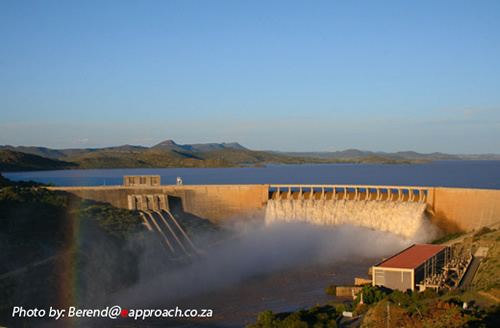
Gariep Dam is a township on the northern bank of the Orange River, 50 km west of Bethulie and 48 km north-east of Colesberg. It was laid out in 1965-66 to accommodate the builders of the dam. The previous name is Afrikaans and means "Orange (River) power". The town acquired its current name in 1996.
References
Gariep Dam (town) Wikipedia(Text) CC BY-SA