
Country United States FIPS code 29-26434 Elevation 281 m Zip code 64747 Area code 816 | Time zone Central (CST) (UTC-6) GNIS feature ID 0718333 Population 1,629 (2013) Local time Friday 7:14 AM | |
 | ||
Weather -2°C, Wind N at 18 km/h, 71% Humidity Area 6.501 km² (6.397 km² Land / 10 ha Water) | ||
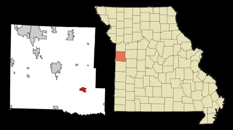
Garden City is a city in Cass County, Missouri, United States. The population was 1,642 at the 2010 census.
Contents
Map of Garden City, MO 64747, USA
History
Garden City was platted in 1885, and so named on account of the fertile soil near the town site. A post office called Garden City has been in operation since 1875.
The O'Bannon Homestead was listed on the National Register of Historic Places in 1979.
Geography
Garden City is located at 38°33′31″N 94°11′21″W (38.558731, -94.189231).
According to the United States Census Bureau, the city has a total area of 2.51 square miles (6.50 km2), of which, 2.47 square miles (6.40 km2) is land and 0.04 square miles (0.10 km2) is water.
2010 census
As of the census of 2010, there were 1,642 people, 650 households, and 436 families residing in the city. The population density was 664.8 inhabitants per square mile (256.7/km2). There were 721 housing units at an average density of 291.9 per square mile (112.7/km2). The racial makeup of the city was 97.4% White, 0.2% African American, 0.9% Native American, 0.2% Asian, 0.4% from other races, and 0.9% from two or more races. Hispanic or Latino of any race were 1.7% of the population.
There were 650 households of which 38.6% had children under the age of 18 living with them, 48.8% were married couples living together, 12.5% had a female householder with no husband present, 5.8% had a male householder with no wife present, and 32.9% were non-families. 27.4% of all households were made up of individuals and 8.8% had someone living alone who was 65 years of age or older. The average household size was 2.53 and the average family size was 3.06.
The median age in the city was 33.1 years. 29.2% of residents were under the age of 18; 8.3% were between the ages of 18 and 24; 27.5% were from 25 to 44; 23.9% were from 45 to 64; and 11.2% were 65 years of age or older. The gender makeup of the city was 49.3% male and 50.7% female.
2000 census
As of the census of 2000, there were 1,500 people, 595 households, and 399 families residing in the city. The population density was 869.0 people per square mile (334.8/km²). There were 630 housing units at an average density of 365.0 per square mile (140.6/km²). The racial makeup of the city was 97.73% White, 0.20% African American, 0.47% Native American, 0.33% from other races, and 1.27% from two or more races. Hispanic or Latino of any race were 1.47% of the population.
There were 595 households out of which 35.5% had children under the age of 18 living with them, 53.3% were married couples living together, 10.3% had a female householder with no husband present, and 32.8% were non-families. 27.7% of all households were made up of individuals and 13.4% had someone living alone who was 65 years of age or older. The average household size was 2.52 and the average family size was 3.11.
In the city the population was spread out with 29.1% under the age of 18, 10.1% from 18 to 24, 30.3% from 25 to 44, 18.5% from 45 to 64, and 11.9% who were 65 years of age or older. The median age was 32 years. For every 100 females there were 93.1 males. For every 100 females age 18 and over, there were 86.8 males.
The median income for a household in the city was $37,461, and the median income for a family was $43,125. Males had a median income of $31,848 versus $20,486 for females. The per capita income for the city was $19,695. About 7.7% of families and 8.0% of the population were below the poverty line, including 7.7% of those under age 18 and 7.1% of those age 65 or over.