
Canton Gardanne INSEE/Postal code 13041 / 13120 Population 20,616 (2012) | Time zone CET (UTC+1) Area 27.02 km² Local time Friday 1:55 PM Team AS Gardanne | |
 | ||
Weather 21°C, Wind NW at 8 km/h, 36% Humidity | ||
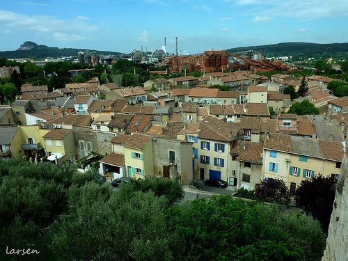
Gardanne is a commune in the Bouches-du-Rhône department in southern France.
Contents
Map of Gardanne, France
Geography
It is close to Aix-en-Provence and Marseille and lies on the rail link connecting the two cities.
History
Walls dating back to the first century AD have been found.
In 1454 René d'Anjou bought the estate and would go there until 1480. In 1482 it was bought back by the Forbins and in 1676 the villagers themselves bought back their own land.
In the 1860s a railway was built and a little later mines were dug, thus attracting Italian, Armenian, Polish, Czech, Spanish and African workers to the village. The deep mine, one of the last surviving in France, was closed down in 2003.
Politics
The commune of Gardanne has been controlled by the Parti Communiste Français under Roger Meï since 1977. Voting is usually towards the left-wing, although rather uncharacteristically Nicolas Sarkozy gained 53.1% of the vote in the second round of the French presidential election, 2007.