
OS grid reference TM005815 Region East Sovereign state United Kingdom Shire county Norfolk Dialling code 01953 | Civil parish Garboldisham Country England Area 11.17 km² District Breckland District UK parliament constituency South West Norfolk | |
 | ||
Population 721 (2001 census)
969 2011 | ||
Garboldisham is a village and civil parish, part of Guiltcross (hundred) in the Breckland district, in Norfolk, England, near the boundary with Suffolk. In the 2001 census the parish had a population of 721 increasing to 969 at the 2011 Census.
Contents
Map of Garboldisham, UK
Origin of name
A D Mills (2003) says it was a 'homestead or village of a man called Gǣrbald'. It appeared in the Domesday Book (1086) as Gerboldesham. The traditional view of Gaerbold is that it is an Old English name, i.e. homestead of Garbold. Others argue it has a Viking origin with Garbold being a famous Viking. As described above, the boundary between Anglian, Viking and possibly even Iceni is blurred in the light of recent genetic and linguistic research.
To the south of the village are the hamlets of Smallworth and Broomscot Common, the name of the latter according to some recalling the village's ancient pagan past, but more likely, so Carole Hough thinks, an affiliation to a Scandinavian with the surname Brun. This name might reflect the Viking invasions or Scandinavian connections of the Wuffingas, founders of the kingdom of East Anglia. It might even go further back in time if you believe theories that the pre-Roman Iceni inhabiting this area were Old English speakers rather than Cymric/Welsh.
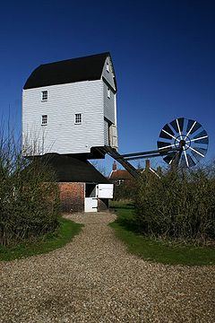
Notable buildings
The village contains a Post Office with independent shop, selling a range of groceries as well as East Anglian regional "gourmet" produce. On Church Road is Garboldisham Church of England School, a primary school with about ninety pupils. The school is next to Garboldisham's St John the Baptist Church and opposite the village hall. About 200 yards north is the ruined Garboldisham All Saints Church, where the 14th century western face collapsed into the nave in 1734. There is also a small methodist chapel, situated south of the A1066. The Fox public house, on the crossroads of the A1066 and Hopton/Harling Road, closed in 2007 but was purchased by a village consortium in 2016 and reopened in December that year.
Village life
There are active cricket and football teams.
The "Garboldisham Road" was mentioned in the infamous Fry and Laurie sketch "Strawberries and Cream". Queen Boudicca was also reputed to be buried in Soldier's Grave, a 10-foot 10,000-year-old burial mound. The Garboldisham Hoard, discovered by Basil Brown in the mound during excavations circa 1956, can be found in the British Museum. John Winston Spencer-Churchill, 7th Duke of Marlborough and grandfather of Sir Winston Churchill, was born in Garboldisham Hall in 1822.