
Length 858 km | ||
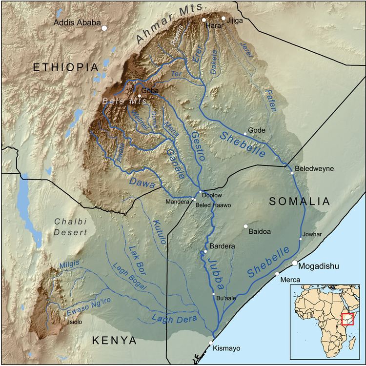 | ||
The Ganale Doria River (also transliterated as Genale Dorya) is a perennial river in southeastern Ethiopia. Rising in the mountains east of Aleta Wendo, the Ganale flows south and east to join with the Dawa at the border with Somalia to become the Jubba. Tributaries include the Welmel, Weyib (also known as Gestro), Dumale, Doya, Hawas and the Hambala. The Del Verme Falls is a notable feature of its middle course.
Map of Genale River, Ethiopia
According to materials published by the Ethiopian Central Statistical Agency, the Ganale has a total length of 858 km (533 mi), of which 480 km (300 mi) are inside that country. The Ethiopian Ministry of Water Resources, describes the catchment area of the Ganale Dorya-Dawa river basin as 171,050 km2 (66,040 sq mi) in size, with an annual runoff of 5.80 billion cubic metres (205×10^9 cu ft), and specific discharge of 1.2 litres per second (0.042 cu ft/s) per square kilometre. The catchment area is estimated as having the potential to irrigate 1,070 km2 (410 sq mi), and to generate 9270 gigawatt-hours per year.
The river Ganale was renamed Ganale Doria by the Italian explorer Vittorio Bottego after the Italian biologist Giacomo Doria.
The Genale Doria is historically important because it served as the boundary between Sidamo and Bale Provinces. The confluence of the Ganale Doria with the Dawa is notable as the starting point for the boundary between Ethiopia and Kenya to the west, and the starting point for the boundary between Ethiopia and Somalia to the east. The Battle of Genale Doria was fought to the south of its course.