
Country Philippines District 2nd District Time zone PST (UTC+8) Area 34.4 km² Province Ilocos Sur | Region Ilocos (Region I) Barangays ZIP code 2709 Local time Friday 6:59 AM | |
 | ||
Weather 25°C, Wind S at 2 km/h, 74% Humidity Neighborhoods Borobor, Calimugtong, Sacaang | ||
Mountain bike adventure to gilong falls baracbac galimuyod ilocos sur philippines
Galimuyod is a fourth class municipality in the province of Ilocos Sur, Philippines. According to the 2015 census, it has a population of 10,748 people.
Contents
- Mountain bike adventure to gilong falls baracbac galimuyod ilocos sur philippines
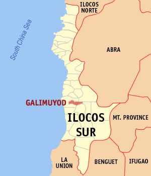
- Map of Galimuyod Ilocos Sur Philippines
- Etymology
- Barangays
- Demographics
- References
Map of Galimuyod, Ilocos Sur, Philippines
Etymology
This town, formerly known as Cabisilan, was once the biggest barrio of Candon during the Spanish Regime. A land dispute between them and residents of neighboring Sapang, another barrio of Candon, resulted in a "gin-nuyod" (Ilocano for "tug-of-war") contest, a common game during those days, to settle it. The people of Cabisilan won over the people of Sapang, making Cabisilan the center of barrios near it. The old folks renamed the barrio Galimuyod, from the Ilocano words tali ("rope") and ginuyod ("pulled").
Barangays
Galimuyod is politically subdivided into 24 barangays.
Demographics
In the 2015 census, the population of Galimuyod was 10,748 people, with a density of 310 inhabitants per square kilometre or 800 inhabitants per square mile.