
Admin. region Karlsruhe Area 4.15 km² Local time Thursday 6:13 PM | Elevation 293 m (961 ft) Population 2,419 (31 Dec 2008) Postal code 69251 | |
 | ||
Weather 13°C, Wind W at 16 km/h, 84% Humidity | ||
Gaiberg is a municipality in the Rhein-Neckar-Kreis of Baden-Württemberg.
Contents
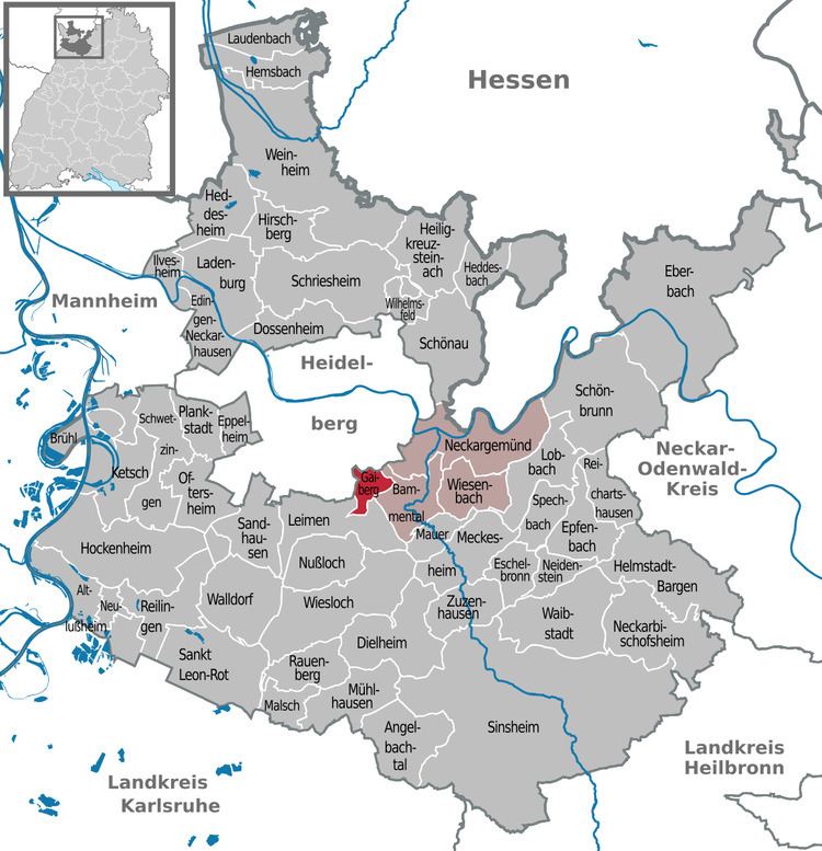
- Map of Gaiberg Germany
- Geography
- History
- Government
- Municipal council
- Coat of arms
- Sister cities
- Transportation
- Education
- References
Map of Gaiberg, Germany
Geography
The state certified climatic health resort (Luftkurort) sits on the border of the Odenwald and the Kraichgau within the Neckartal-Odenwald national park, about 10 km south of Heidelberg.
To the south of Gaiberg lies Leimen. To the north and west lies Heidelberg. To the east lies Bammental.
History
The settlement which appeared in the late Middle Ages, was bought by Electorate of the Palatinate in 1419. In 1803 Gaiberg became part of Baden.
Government
Gaiberg belongs to the Neckargemünd municipal association. The seat of the municipal association is in Neckargemünd.
Municipal council
In addition to the chairperson and mayor, there are 12 councilors.
Coat of arms
The coat of arms is based on a court seal from 1751. It depicts a column next to a tree. The meaning of the symbols is not explained. In 1900 the municipality adopted the coat of arms at the suggestion of the General State Archiv.
The flag is green and white and was awarded by the Ministry of the Interior in 1956.
Sister cities
Transportation
The municipality connect to the regional highway net by 8 km of state road to the exit Heidelberg/Schwetzingen of Bundesautobahn 5.
Education
In Gaiberg there is a primary and secondary school with a vocational school. Schools for further education can be found in Leimen and Heidelberg. There are Gymnasien in Neckargemünd and Bammental.