
Established 14 August 2001 Local time Thursday 7:36 PM University Baqai Medical University | Website Gadap Town Page | |
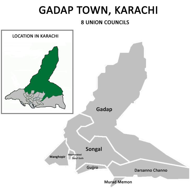 | ||
Union Councils 8Darsano ChanaGadapGujroManghopirMaymarabadMurad Memon GothSongalYousuf Goth office location Town Municipal Administration Gadap, Old MDA office, Memon Goth, Malir, Karachi 75320 Weather 25°C, Wind SW at 23 km/h, 60% Humidity | ||
Gadap Town (Sindhi: گڏاپ ٽائون , Urdu: گڈاپ ٹاؤن ) is a town in the northwestern part of Karachi with the Hub River on its western limits also forming the provincial border between Sindh and Balochistan, while to the north and east are Jamshoro District and the Kirthar Mountains. Before the independence of Pakistan, there were small villages of Kalmati Baloch tribe in the Gadap and Malir Town of modern Karachi. Now both towns are developed as the suburbs of the city because of the urban sprawl.
Contents
Map of Gadap Town, Karachi, Pakistan
Neighbourhoods
The neighbourhoods of Murad Memon Goth, (Mula Essa Goth), Gujro, Maymarabad, Yousuf Goth, Peer Goth, Sheedi Goth, Darsano Channo, Somar Kandani and Jam Goth are densely populated whereas the remaining areas are mostly rural, especially Gadap neighbourhood which is the largest union council by area of Karachi.
There over 400 rural villages in Gadap Town. Some of the rural villages of Gadpap Town are Old Thana Village, Mula Essa Goth, Jam Goth, Memon Goth, Haji Miandad Goth, Samoon Goth, Haji Murad Jaffar Goth, Darsano Chhano, Kathore, Saleh Mohammad Goth, Kohi Goth, etc.