
Length 2,273 km | ||
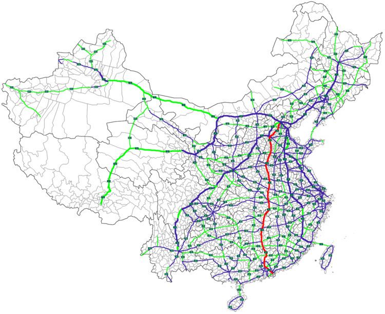 | ||
North end: Liuli Bridge, West 3rd Ring Road, Beijing South end: Huanggang Road, Huanggang Port Control Point, Shenzhen, Guangdong | ||
The Beijing–Hong Kong–Macau Expressway (Chinese: 北京-香港-澳门高速公路), commonly referred to as the Jinggang'ao Expressway (Chinese: 京港澳高速公路) is a 2,272.65-kilometre-long expressway (1,412.16 mi) that connects the Chinese cities of Beijing and Shenzhen, in Guangdong province, at the border with Hong Kong. The expressway terminates at the Huanggang Port Control Point in Shenzhen, opposite the Lok Ma Chau border control point in Hong Kong. The connection to Zhuhai at the Macau border is made using the spur line G4W Guangzhou–Macau Expressway, which branches off from the main line in Guangzhou. When the expressway was completed in October 2004, it was China's first completed north-south expressway route.
Contents
Map of G4, China
Route
The major cities connected by this expressway are following.
The expressway ends at Huanggang Port, Shenzhen, connected with the road to Hong Kong.
History
The Expressway began as the Jingshi Expressway linking Beijing to Shijiazhuang, Hebei. Construction of this 270 km section began in April 1986 and was opened in full in 1993. This first section is previously numbered G030 .
In October 2015, the expressway experienced a serious traffic jam at the end of the Golden Week holiday caused in the main part by the introduction of a new toll booth near Beijing. The toll booth forced cars exiting from 50 lanes into just 20.
Detailed Route
The following is a list of towns, cities and major interchanges along the expressway as of 2012.