
Elevation(AMSL) 289 m (948 ft) Local time Monday 1:08 AM | Time zone CET (UTC+0) Population 18,751 (2014) | |
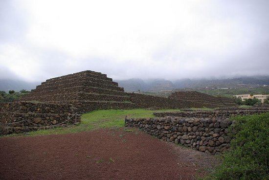 | ||
Weather 17°C, Wind N at 8 km/h, 64% Humidity Points of interest Pyramids of Güímar, Malpaís de Güímar, Lavaderos de Chacaica, MoringaPark Tenerife, Ventanas De Guimar | ||
Güímar ([ˈgwimar]) is the name of a municipality, town, and valley in the eastern part of the Spanish island of Tenerife, one of the Canary Islands, and part of Santa Cruz de Tenerife (province). The municipality and extends for 1,029 square kilometers from the mountainous interior to the beaches on the Atlantic, and borders the municipalities of La Orotava, Arafo, and Fasnia. Its estimated population is 18,589 (2013). The TF-1 motorway passes through the municipality.
Contents
Map of G%C3%BC%C3%ADmar, Santa Cruz de Tenerife, Spain
The municipality is famous for its Guanche pyramids. It is also the location of the barranco de Badajoz. A portion of its volcanic landscape has been set aside as the Nature reserve of Malpaís of Güímar, its highest point being Montaña Grande.
Nice hiking path in g mar de tenerife
References
Güímar Wikipedia(Text) CC BY-SA