
Admin. region Unterfranken Municipal assoc. Gemünden am Main Area 11.5 km² Local time Sunday 11:12 PM | District Main-Spessart Elevation 160-289 m (−788 ft) Population 1,288 (31 Dec 2008) Postal code 97780 | |
 | ||
Weather 5°C, Wind E at 14 km/h, 64% Humidity | ||
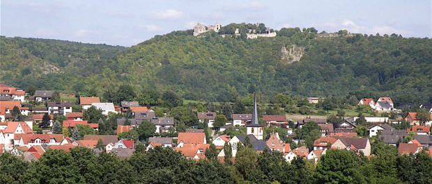
Gössenheim is a community in the Main-Spessart district in the Regierungsbezirk of Lower Franconia (Unterfranken) in Bavaria, Germany and a member of the Verwaltungsgemeinschaft (Administrative Community) of Gemünden am Main.
Contents
- Map of GC3B6ssenheim Germany
- Location
- Constituent communities
- History
- Population development
- Politics
- Coat of arms
- Economy and infrastructure
- Education
- References
Map of G%C3%B6ssenheim, Germany
Location
Gössenheim lies on the river Wern in the Würzburg Region.
Constituent communities
Gössenheim’s Ortsteile are Gössenheim and Sachsenheim.
History
Already by the early 7th century, the Main-Wern area was under the Merovingian Empire’s yoke and Frankish settlers had established themselves here in great numbers. Thus arose in the Wern valley a mixed population of Alamannic, Thuringian, Warnian and Frankish.
Historically, Gössenheim had its first documentary mention in 788. On 18 January that year, Count Manto and his brother Megingoz donated their holdings in Veringewe (Werngau), Heselere (Heßlar), Tüngide (Thüngen), Binzufeld (Binsfeld), Haholtesheim (Halsheim), Steti (Stetten), Büthult (Büchold) and Gysenheim (Gössenheim) to the Fulda Abbey. Already by Charlemagne’s time Gössenheim must have been a kingly estate and not at all an unimportant place.
The Homburg (actually “Hohenberg” – High Mountain – a castle) was built in the early 1170s by the Lords of Hohenberg, who were Würzburg ministeriales. Through inheritance it passed to the Bickenbach family in 1381. In 1469, the community along with the Homburg and the surrounding places was sold to the Prince-Bishopric of Würzburg.
Gössenheim was until about 1870 a fortified village whose core was shielded to the east, north and west by a ringwall, some of which still stands today. Gössenheim now lies on Bundesstraße 27 between Karlstadt and Hammelburg, and it belongs to the local area of the lesser centre of Gemünden in the Würzburg Region.
Gössenheim’s main landmark is the mighty, albeit ruined, Homburg. Well known far beyond the limits of the local area is the singers’ festival that for the last 50 years has taken place at the Homburg on Whit Monday, drawing visitors from near and far. Even the wine made from the grapes grown at the new vineyards bears the ruin’s name: “Gössenheimer Homburg”.
Population development
Within town limits, 1,070 inhabitants were counted in 1970, 1,167 in 1987, 1,272 in 2000 and in 2006 1,357.
Politics
The mayor is Theo Gärtner. He succeeded Johann Popp in 2008.
Municipal taxes in 1999 amounted to €615,000 (converted), of which net business taxes amounted to €186,000.
Goessenheim forms together with Karsbach and Gräfendorf the Verwaltungsgemeinschaft Gemünden which provides communal services to its citizens.
Coat of arms
The community’s arms might be described thus: Per fess in chief argent three lozenges gules in fess, below which dancetty of three of the second and first and a plain point azure.
Economy and infrastructure
According to official statistics, there were 269 workers on the social welfare contribution rolls working in producing businesses in 1998. In trade and transport this was 28. In other areas, 46 workers on the social welfare contribution rolls were employed, and 416 such workers worked from home. There was one processing business. Five businesses were in construction, and furthermore, in 1999, there were 23 agricultural operations with a working area of 281 ha, of which 239 ha was cropland and 33 ha was meadowland.
Education
As of 1999 the following institutions existed in Gössenheim: