
Admin. region Freiburg Elevation 612 m (2,008 ft) Area 50.42 km² Population 4,398 (31 Dec 2008) Dialling code 07754 | Time zone CET/CEST (UTC+1/+2) Local time Sunday 11:10 PM Postal code 79733 Administrative region Freiburg | |
 | ||
Weather 4°C, Wind N at 5 km/h, 67% Humidity | ||
Görwihl is a town in the district of Waldshut in Baden-Württemberg in Germany.
Contents
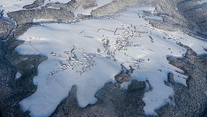
Map of 79733 G%C3%B6rwihl, Germany
History
The name is derived from the ancient German for spear, due to the spearhead shape of the area at the time.
Görwihl was established in 1193, and was first recorded as Gerswillare. Like many places in the region, Görwihl belonged to the county Hauenstein within Further Austria. It became the centre of legal activity for the region and played a role in the peasants' uprising. In 1806, Görwihl became part of the newly created Grand Duchy of Baden.
The community in its present scale was developed in the context of Baden-Wurttemberg regional reform. Rotzingen joined the municipality of Görwihl in 1971 and Hartschwand in 1972, with the other districts following in 1975.
Geography
Görwihl is within the Hotzenwald region, and lies in the southernmost part of the Black Forest, at the edge of the River Alb, a tributary of the Rhine. The landscape of the region is characterized by high plateaus of various sizes, the stepped terraces descending toward the south. About 60% of the area within the town boundary consists of forest.
The community is bordered to the north by Ibach, on the east by Albbruck, in the south by the city of Laufenburg and on the west by Rickenbach and Herrischried.