
District Grafschaft Bentheim Elevation 19 m (62 ft) Area 20.95 km² Population 628 (31 Dec 2008) | Time zone CET/CEST (UTC+1/+2) Local time Sunday 10:34 PM Postal code 49843 | |
 | ||
Weather 7°C, Wind E at 11 km/h, 62% Humidity | ||
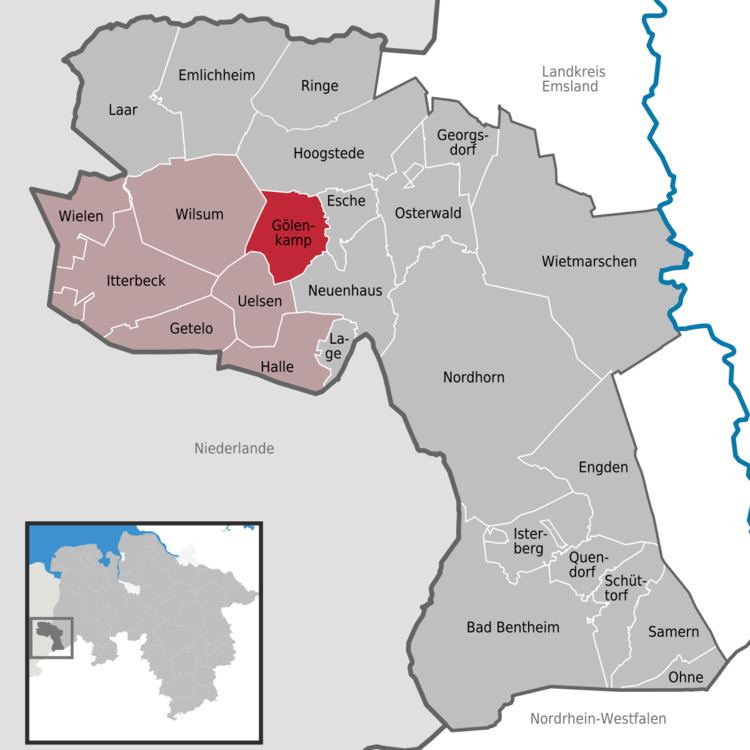
Gölenkamp is a community in the district of Grafschaft Bentheim in Lower Saxony.
Contents
Map of G%C3%B6lenkamp, Germany
Location
Gölenkamp lies northwest of Nordhorn. It belongs to the Joint Community (Samtgemeinde) of Uelsen, whose administrative seat is in the town of the same name.
Constituent communities
The community’s three centres are Gölenkamp, Haftenkamp and Hardinghausen.
Mayor
Jan Benierman was elected honorary mayor in 2006.
Buildings
Spöllberg, a barrow from the Bronze Age, is located in Gölenkamp.
References
Gölenkamp Wikipedia(Text) CC BY-SA