
- Tree Sakura Area 205.5 km² Local time Sunday 3:57 AM | Region Kantō Population 45,309 (1 Dec 2015) | |
 | ||
Weather 6°C, Wind NW at 6 km/h, 95% Humidity Points of interest Mount Nokogiri, Cap Futtsu, Nokogiriyama Ropeway, Tokyowankannon, Kanaya Museum | ||
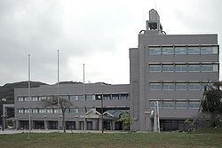
Futtsu (富津市, Futtsu-shi) is a city located in Chiba Prefecture, Japan.
Contents
- Map of Futtsu Chiba Prefecture Japan
- Geography
- Neighboring municipalities
- History
- Economy
- Education
- Railway
- Highway
- Sister city relations
- Local attractions
- Notable people from Futtsu
- References
Map of Futtsu, Chiba Prefecture, Japan
As of December 2015, the city had an estimated population of 45,309 and a population density of 220 persons per km². The total area was 205.53 square kilometres (79.36 sq mi).
Geography
Futtsu is located on the southwest coast of Bōsō Peninsula, south-southwest of the city of Chiba facing the Uraga Channel and almost due south of the capital city of Tokyo at the southern end of Tokyo Bay.
Neighboring municipalities
Chiba Prefecture
History
The area of modern Futtsu has been inhabited since the Japanese Paleolithic period, and numerous remains from the Jōmon, Yayoi and Kofun period have been found within the city limits. The area also is prominent in the Yamatotakeru mythology. Under the Ritsuryō system of the Nara period, the area became part of Amaha County and Sue County of Kazusa Province. Large scale shōen in the Heian period gave way to feudal samurai estates in the Kamakura period, with large portions controlled by the temple of Shomyo-ji in Mutsuura. The area was contested between the Takeda clan and Satomi clan during the Sengoku period. During the Edo period under the Tokugawa shogunate, most of the area was under the control of Sanuki Domain. After the Meiji Restoration, the area came under Kimitsu District
Futtsu Town was founded on December 1, 1897. It expanded through merger with neighboring Aoyagi Town on March 31, 1955, and again through merger with Amaha Town and Osawa Town on April 25, 1971. Futtsu attained city status on September 1, 1971.
According to Victory at Sea (H. Saloman and R. Hanser, Doubleday, 1959), Futtsu was on August 30, 1945 the site of the initial Allied landing on the Japanese mainland following the declared surrender. This was a test whether the Japanese would obey the Emperor's surrender order. There was no resistance.
Economy
Futtsu has a mixed economy based on commercial fishing, agriculture, tourism, and electrical power generation.
Education
Futtsu has 12 elementary schools, five middle schools and two high schools.
Railway
Highway
Futtsu has two interchanges (Futtsu-Chūō and Futtsu-Geoka) with the Tateyama Expressway and is the southernmost terminus, it has a link with a lesser expressway with one of the two interchanges called Futtsu-Kanaya. Futtsu is also connected by: