
Time zone China Standard (UTC+8) Postal code 66300 | Elevation 21 m (69 ft) Area code(s) 0335 Local time Saturday 10:10 PM | |
 | ||
Country People's Republic of China County seat Licheng Subdistrict (骊城街道) Weather 6°C, Wind NE at 2 km/h, 62% Humidity Points of interest Nandaihe Pleasure City, Sea Paradise | ||
Funing County (simplified Chinese: 抚宁区; traditional Chinese: 撫寧區; pinyin: Fǔníng Qū) is a district of northeastern Hebei Province, China, located about 30 km (19 mi) to the west of Qinhuangdao, which administers it. As of 2001, it had a population of 510,000 residing in an area of 1,646 km2 (636 sq mi).
Contents
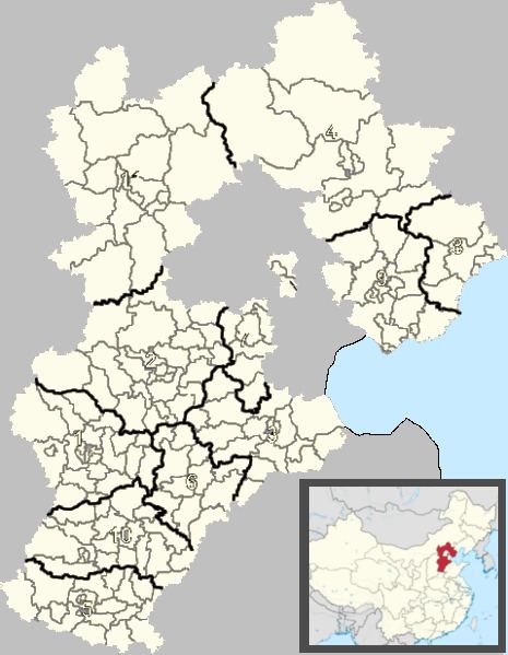
Map of Funing, Qinhuangdao, Hebei, China
Administrative divisions
The district administers 2 subdistricts, 5 towns and 2 townships.
Subdistricts:
Towns:
Townships:
Transport
References
Funing District Wikipedia(Text) CC BY-SA