
Time zone UTC-3 (UTC-3) Elevation 41 m Population 17,632 (2012) | Founded 5 July 1923 Postal Code 29185-000 Area 279.6 km² Local time Saturday 10:41 AM | |
 | ||
Weather 31°C, Wind NW at 11 km/h, 60% Humidity | ||
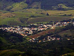
Fundão ([fũⁿˈdɐ̃w]) is a municipality in Espírito Santo, south eastern Brazil. Its population was 16,431 (2009) and its area is 280 km².
Contents
Map of Fund%C3%A3o, State of Esp%C3%ADrito Santo, Brazil
History
This municipality was created on the 5 July 1923. It was created from part of Nova Almeida municipality, which today is no longer a municipality but a town (distrito in Portuguese) of Serra municipality.
Location
Situated about 57 km from the state capital Vitória. Bordering municipalities include: Aracruz and Ibiraçu (N), Santa Teresa and Santa Leopoldina (W), Serra, Espírito Santo (S) and the Atlantic Ocean (E).
The coastline of the municipality is protected by the 112,545 hectares (278,100 acres) Costa das Algas Environmental Protection Area, created in 2010.
References
Fundão, Espírito Santo Wikipedia(Text) CC BY-SA