
Population 106,736 (2010) Local time Saturday 4:31 PM | Region Kantō Area 19.77 km² | |
 | ||
Weather 13°C, Wind S at 6 km/h, 47% Humidity | ||
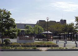
Fujimi (富士見市, Fujimi-shi) is a city located in Saitama Prefecture, in the central Kantō region of Japan. As of 1 February 2016, the city had an estimated population of 108,212 and a population density of 5470 persons per km². Its total area was 19.77 square kilometres (7.63 sq mi).
Contents
- Map of Fujimi Saitama Prefecture Japan
- Geography
- Surrounding municipalities
- History
- Politics and government
- Elections
- Economy
- Education
- Railway
- Highway
- Sister city relations
- Local attractions
- Noted people from Fujimi
- References
Map of Fujimi, Saitama Prefecture, Japan
Geography
Located in south-central Saitama Prefecture, Fujimi is in the middle of the Kantō plain with an average altitude of 8 to 21 meters above sea level. It is approximately 30 kilometers from downtown Tokyo.
Surrounding municipalities
History
The area of modern Yoshikawa was tenryō territory within Shimōsa Province during the Edo period Tokugawa shogunate. The village of Fujimi was created within Iruma District, Saitama on September 30, 1956 by the merger of the villages of Tsuruse and Nanbata with the village of Mizutani from Kitaadachi District. Large scale public housing projects in the 1960s and 1970s led to a rapid increase in population, and Fujimi attained town status on April 1, 1964 and city status on April 10, 1972.
Politics and government
Fujimi is governed by Shingo Hoshino, an independent. The city legislative assembly has 25 seats and is dominated by independents.
Elections
Economy
Due to this location, Fujimi is primarily a bedroom community with over 30% of its population commuting to the Tokyo metropolis for work.
Education
Fujimi has 11 elementary schools, six middle schools and one high school, as well as one special education school.