
 | ||
Frontier region dera ismail khan
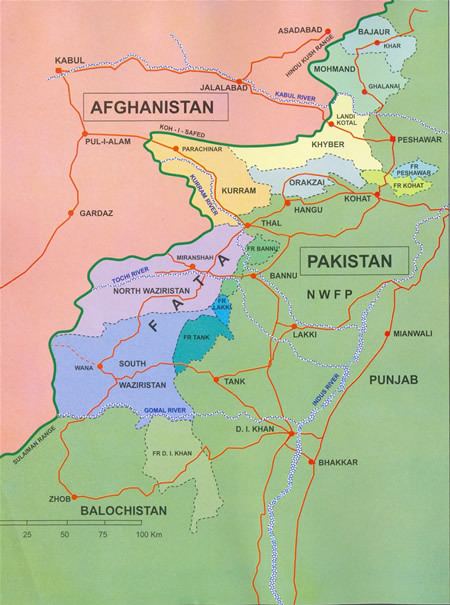
The Frontier Region Dera Ismail Khan (often abbreviated as F.R. D.I. Khan) is a small administrative unit in the Federally Administered Tribal Areas (FATA) of Pakistan. The region is named after Dera Ismail Khan District which lies to the east and also borders South Waziristan Agency to the north, Dera Ghazi Khan and Musa Khel to the south and Zhob to the west. It is administered by the district coordination officer (DCO) of Dera Ismail Khan District. The overall administration of the Frontier Regions is carried out by the FATA Secretariat based in Peshawar, the capital of the Khyber Pakhtunkhwa Province. The main village of the frontier region is Darazinda, which borders South Waziristan.
Contents
Geography and climate
The geography of Frontier Region Dera Ismail Khan is mostly hilly as it lies near Sulaiman Range. The Sherani Area is totally under the eastern shadow of highest peak of Takht-e-sulaiman. The northern side is bounded by Gomal pass.
The climate of Frontier Region Dera Ismail Khan from December to February is cold, and from May to September is warm. Kulachi is the most historical tehsil of Dera Ismail Khan.
Demography
The population according to the 1998 census is 39,000. The first language of 99.3% of the population is Pashto. The tribes are Gandapure, Wazir, Mahsood, Bhattni, Marwat and Sherani among others. Some baloch are also present in the area.
Education
According to the Alif Ailaan Pakistan District Education Rankings 2015, FR Dera Ismail Khan is ranked 127 out of 148 districts in terms of education. For facilities and infrastructure, the district is ranked 95 out of 148.