
Similar Mai Po Marshes, Robin's Nest, Lok Ma Chau Station, Lo Wu Station, Ap Chau | ||
sha tau kok frontier closed area
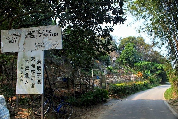
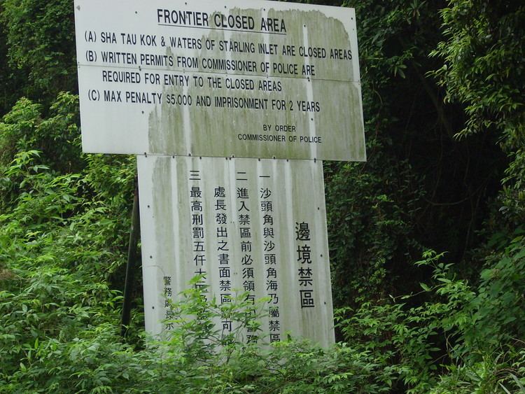
The Frontier Closed Area (also Boundary Closed Area), established by the Frontier Closed Area Order, 1951, is a border zone area in Hong Kong extended inwards from the border with China. For anyone to enter the area, a Closed Area Permit is required.
Contents
- sha tau kok frontier closed area
- Frontier closed area ta kwu ling to lo wu erl
- Closed Area Permit
- 2006 reduction proposal
- First phase of implementation
- Areas lying in Frontier Closed Area
- References
Established to prevent migrants from China and other illegal activities, the closed area is fenced along its perimeter to serve as a buffer between the closed border and the rest of the territory. Developments are tightly controlled within the area, which has become a natural habitat for animals and plants.
Frontier closed area ta kwu ling to lo wu erl
Closed Area Permit
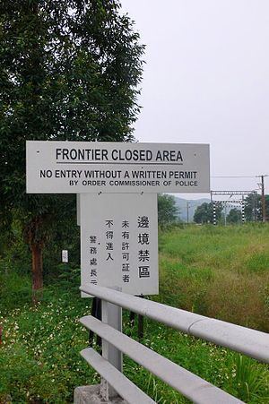
A Closed Area Permit is a document issued by the Hong Kong Police Force to allow for select individuals with ties or residents in the area to travel in and out of the Frontier Closed Area. As well visitors to the Mai Po Marshes are also required to apply for a Mai Po Marshes Entry Permit from the Agriculture, Fisheries and Conservation Department.
2006 reduction proposal
Reduction of the FCA from 28 square kilometres (11 sq mi) (its size at the time) to 8 square kilometres (3.1 sq mi) was proposed in September 2006 by the government. According to the adopted proposal, most of the FCA will be de-designated and the FCA only maintained around border crossings.
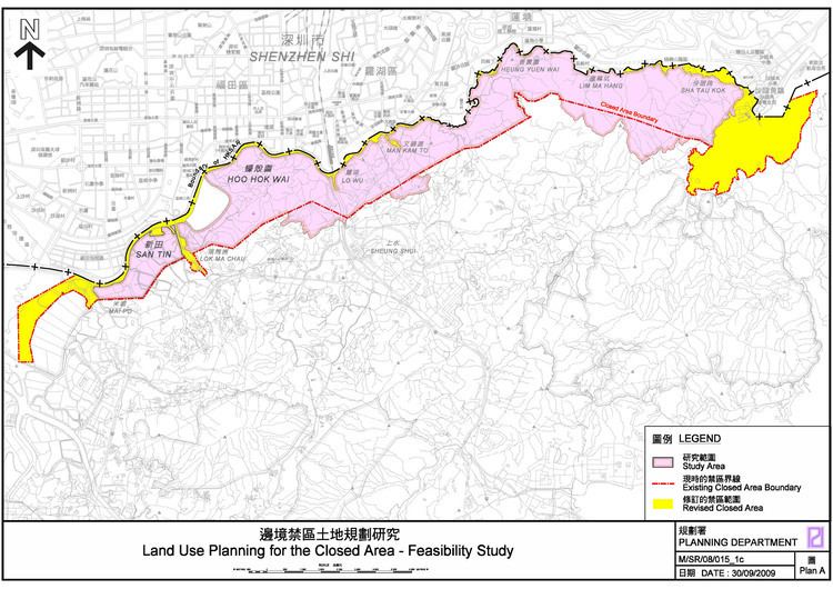
This will be made possible by the building of a secondary fence along the border roads, such that most villages in the FCA will fall outside of it without having to compromise the integrity of the border. A planning study was to have been undertaken by the Planning Department.
Depending upon the progress of the new fence, the reduction will be implemented in four stages with scheduled completion in early 2015. Members of the public will no longer need to obtain a permit to enter the excluded areas.
The proposal was welcomed by most residents. However, some environmentalists have pointed out that the proposal will have negative impacts on the ecology of the excluded areas.
First phase of implementation
On 15 February 2012, areas around Sha Tau Kok (but not the town itself), as well as Mai Po, were taken out of the Frontier Closed Area, opening up 740 hectares (1,800 acres) of land for public access. A checkpoint on the original perimeter, at Shek Chung Au, was decommissioned and its functions taken over by a new checkpoint outside of Sha Tau Kok.