
Country United States | Population 4,757,713 | |
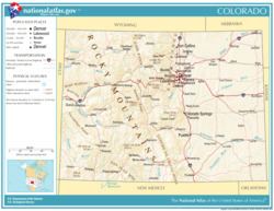
The Front Range Urban Corridor is an oblong region of urban population located along the eastern face of the Southern Rocky Mountains, encompassing 18 counties in the U.S. states of Colorado and Wyoming. The corridor derives its name from the Front Range, the mountain range that defines the west central boundary of the corridor. The region comprises the northern portion of the Southern Rocky Mountain Front geographic area, which in turn comprises the southern portion of the Rocky Mountain Front geographic area of Canada and the United States. The Front Range Urban Corridor had an estimated population of 4,757,713 on July 1, 2015, an increase of +9.78% since the 2010 United States Census.
Contents
ExtentEdit
The Front Range Urban Corridor stretches from Pueblo, Colorado, north along Interstate 25 to Cheyenne, Wyoming, and includes the Denver-Aurora-Lakewood, CO Metropolitan Statistical Area, the Colorado Springs, CO Metropolitan Statistical Area, the Boulder, CO Metropolitan Statistical Area, the Fort Collins, CO Metropolitan Statistical Area, the Greeley, CO Metropolitan Statistical Area, the Pueblo, CO Metropolitan Statistical Area, the Cheyenne, WY Metropolitan Statistical Area, and the Cañon City, CO Micropolitan Statistical Area. The corridor comprises three primary subregions: the South Central Colorado Urban Area, the North Central Colorado Urban Area, and the Cheyenne Metropolitan Area.

The influence of the Corridor extends well beyond its defined boundaries. The Colorado Eastern Plains, Nebraska Panhandle and Albany County, Wyoming, among other areas, are culturally and economically tied to the Corridor, though they are not considered to be a part of it.
The definition included here is not used for the greater Front Range Megaregion, one of the 11 megaregions of the United States. The megaregion's area is more expansive, extending south from Pueblo along the I-25 corridor into New Mexico, including Albuquerque and Santa Fe, and also including the Wasatch Front of Utah, separated by hundreds of miles from the regional core.
The table below includes the following information:
- The urban region.
- The Core Based Statistical Area (CBSA) as designated by the United States Office of Management and Budget.
- The CBSA population as of July 1, 2015, as estimated by the United States Census Bureau.
- The county.
- The county population as of July 1, 2015, as estimated by the United States Census Bureau.
- The county population as of April 1, 2010, as enumerated by the 2010 United States Census.
- The percent county population change from April 1, 2010, to July 1, 2015.
Wyoming jurisdictionsEdit
In the State of Wyoming, the Front Range Urban Corridor includes the Town of Albin, the Town of Burns, the City of Cheyenne, the Town of Pine Bluffs, and unincorporated Laramie County.
Colorado jurisdictionsEdit
In the State of Colorado, the Front Range Urban Corridor includes: