Admin. region Stuttgart Elevation 323 m (1,060 ft) Area 11.35 km² Local time Friday 5:23 PM Administrative region Stuttgart | Time zone CET/CEST (UTC+1/+2) Population 8,770 (31 Dec 2008) Postal code 72636 | |
 | ||
Weather 16°C, Wind W at 29 km/h, 58% Humidity | ||
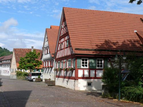
Frickenhausen is a town in the district of Esslingen in Baden-Württemberg in Germany.
Contents
- Map of 72636 Frickenhausen Germany
- History
- Religions
- Tischardt
- Linsenhofen
- Freemen
- Personalities who have worked locally
- Literature
- References
Map of 72636 Frickenhausen, Germany
History
For the first time the municipality was called in the early 14th century Frickenhusen. The main source of income was the growing of wine. However, epidemics, war and bad harvests made the income volatile, so many people worked from mid-18th century on linen weaving, spinning and flax.
Today's Protestant church was built in 1500 as a late Gothic village church.
Religions
Since the reformation Frickenhausen is dominated Protestant. Today there are in each of the three districts a Protestant church. In the center there is also again a Roman Catholic church and since several years a New Apostolic congregation.
Tischardt
The municipality Tischardt was incorporated on April 15, 1972 to the municipality Frickenhausen. The coat of arms was adopted in 1923, it shows in a blue shield a silver table, behind are three silver trees.
Linsenhofen
Linsenhofen came on January 1, 1975, by incorporation to Frickenhausen. Linsenhofen was first mentioned in 1137 in the Zwiefalter Chronik. The coat of arms can be detected since 1778. On a seal two men are seen, holding a grape between them standing.
