
 | ||
Similar Freycinet National Park, Great Oyster Bay, The Hazards, Bay of Fires, Cape Tourville Lighthouse | ||
The Freycinet Peninsula is a large peninsula located on the eastern coast of Tasmania, Australia. The peninsula is located north of Schouten Island and is contained within the Freycinet National Park.
Contents
Map of Freycinet Peninsula, Freycinet TAS 7215, Australia
Features and location
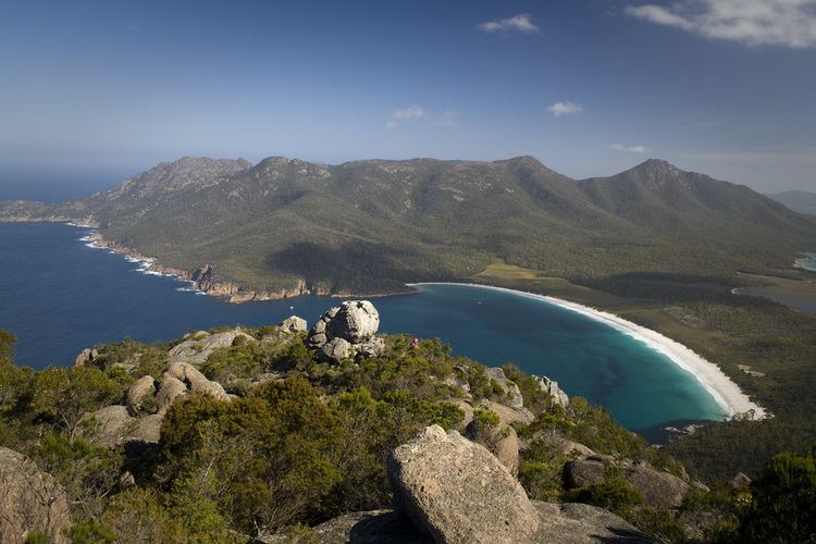
The peninsula is a large, dramatic land formation carved into Tasmania's eastern coastline. Known for its pink granite mountain range, The Hazards, and its sheltered, white sand beaches, the peninsula is the location for Freycinet National Park, the first national park to be declared in Tasmania, along with Mt Field National Park. Also on the peninsula is the village of Coles Bay, the Friendly Beaches Reserve, and Wineglass and Honeymoon bays.
Early history
The "Vanderlyn Island" was the last sighting of Australia by Abel Tasman in 1642 before turning east to New Zealand.
The first landing by Europeans was by Captain Weatherhead of the transport ship Matilda on 27 July 1791. Due to the narrow northern isthmus, Weatherhead and Tasman mistook it for an island. Nicholas Baudin named the peninsula after French explorer Louis de Freycinet. Baudin also named Cape Baudin, Cape Faure, Cape Forestier and Thouin Bay, although that bay is now known as Wineglass Bay.