
Time zone CET/CEST (UTC+1/+2) Population 41,823 (31 Dec 2008) Postal code 09599 | Elevation 400 m (1,300 ft) Postal codes 09599 Local time Friday 7:10 AM | |
 | ||
Weather 6°C, Wind SW at 24 km/h, 62% Humidity University Freiberg University of Mining and Technology | ||
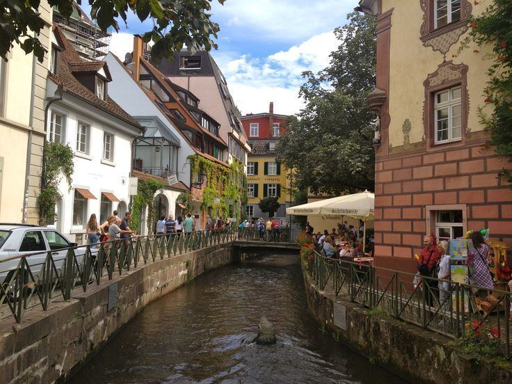
Freiberg (German for "free for mining activities") is a university and mining town in the Free State of Saxony, Germany. It is a so-called Große Kreisstadt (large county town) and the administrative centre of Mittelsachsen district.
Contents
- Map of Freiberg Germany
- Location
- Expansion of the town
- Surrounding area
- History
- Regular events
- Twin townsSister cities
- Freemen
- Sons and daughters of the town
- References
Map of Freiberg, Germany
Its historic town centre has been placed under heritage conservation and is a chosen site for the proposed UNESCO World Heritage Site known as the Ore Mountain Mining Region. Until 1969, the town was dominated for around 800 years by the mining and smelting industries. In recent decades it has restructured into a high technology site in the fields of semiconductor manufacture and solar technology, part of Silicon Saxony.
Location
The town lies on the northern declivity of the Ore Mountains, with the majority of the borough west of the Eastern or Freiberger Mulde river. Parts of the town are nestled in the valleys of Münzbach and Goldbach streams. Its centre has an altitude of about 412 m above NHN (at the railway station). Its lowest point is on Münzbach on the town boundary at 340 m above NHN; its highest point is on an old mining tip at 491 m above NHN. Freiberg lies within a region of old forest clearances, subsequently used by the mining industry which left its mark on the landscape. The town is surrounded to the north, southeast and southwest by woods, and in the other directions by fields and meadows. Since the beginning of the 21st century an urbanised area has gradually developed which is formed by the towns of Nossen, Roßwein, Großschirma, Freiberg and Brand-Erbisdorf. It has currently about 75,000 inhabitants.
Freiberg is located about 31 kilometres west-southwest of Dresden, about 31 kilometres east-northeast of Chemnitz, about 82 kilometres southeast of Leipzig, and about 179 kilometres south of Berlin and about 120 kilometres northwest of Prague.
Freiberg lies on a boundary between two variants of the Saxon dialect: the Southeast Meissen dialect (Südostmeißnisch) to the east and the South Meissen dialect (Südmeißnisch) to the west of the town, both belonging to the five Meissen dialects, as well as just north of the border of the dialect region of East Erzgebirgisch.
Expansion of the town
The nucleus of the town, the former forest village of Christiansdorf lies in the valley of the Münzbach stream. The unwalled town centre grew up on its two slopes and on the ridge to the west. This means inter alia that the roads radiating outwards east of the old main road axis (today Erbische Straße and Burgstraße running from the former Erbisch Gate (Erbischer Tor) on Postplatz to Freudenstein Castle), some of which run as far as the opposite side of the Münzbach valley, are very steep. The area located east of the main road axis is called Unterstadt ("Lower Town"), with its lower market or Untermarkt. The western area is the Oberstadt ("Upper Town") where the Obermarkt or "Upper Market" is situated. The town centre is surrounded by a green belt running along the old town wall. In the west, this belt, in which the ponds of the Kreuzteichen are set, broadens out into an area like a park. Just north of the town centre, is Freudenstein Castle as well as the remnants of the town wall with several wall towers and Schlüsselteich pond in front of them. The remains of the wall run eastwards, in sections, to the Donats Tower. This area is dominated by the historic moat. The southern boundary of the old town is characterized in places by buildings from the Gründerzeit period. The B 101 federal road, here called Wallstraße, flanks the west of the town centre, the B 173, as Schillerstraße and Hornstraße, bounds it to the south.
Freiberg's north is dominated by the campus of its University of Mining and Technology. The main part of the campus on either side of Leipziger Straße (as the B 101 road, the most important transport link in this district) emerged in the 1950s and 1960s. Furthermore, the districts of Lossnitz, Lößnitz and Kleinwaltersdorf are found here, extending almost out to the boundary of the borough. Between Kleinwaltersdorf and Lößnitz is the Nonnenwald wood, and east of Leipziger Straße is a trading estate.
Surrounding area
In the area around Freiberg there are both industrial estates as well as agricultural and recreational areas. Smelting and metalworking firms are based at Muldenhütten and Halsbrücke and paper manufacturers at Weißenborn and Großschirma. Northeast of the town is the recreational area of the Tharandt Forest
The town of Großschirma lies north of Freiberg on the B 101 federal road. To the northeast the municipality of Halsbrücke borders on the territory of Freiberg's borough and, to the east, is the municipality of Bobritzsch-Hilbersdorf. The municipality of Weißenborn to the southeast belongs to the Verwaltungsgemeinschaft of Lichtenberg/Erzgebirge. On the B 101 south of Freiberg is the Große Kreisstadt of Brand-Erbisdorf and to the east is the municipality of Oberschöna.
History
The town was founded in 1186 and has been a centre of the mining industry in the Ore Mountains for centuries. A symbol of that history is the Freiberg University of Mining and Technology, often just known as the Mining Academy (Bergakademie), established in 1765 and the second oldest university of mining and metallurgy in the world. (In North Hungary, in Selmecbánya town /now Banská Štiavnica, Slovakia/ a Mining Academy was established at 1735) Freiberg also has a notable cathedral containing two famous Gottfried Silbermann organs. There are two other organs made by Gottfried Silbermann - one at the St. Peter's Church (Petrikirche) and the other one at the St. James' Church (Jakobikirche). The medieval part of Freiberg stands under heritage protection.
The river, Freiberger Mulde, flows through the borough of Freiberg, but not the town itself.
In 1944, a subcamp of Flossenbürg concentration camp, was built outside the town of Freiberg. It housed over 500 female survivors of other camps, including Auschwitz Birkenau. Altogether 50 or so SS women worked in this camp until its evacuation in April 1945. The female survivors eventually reached Mauthausen concentration camp in Austria.
In 1985, Mormons built the Freiberg Germany Temple here because of the large number of members in the region. The Freiberg Germany Temple serves Mormons from all over Eastern Germany and majority of the East Europe.
Regular events
Every year in Freiberg the Mining Town Festival (Bergstadtfest) is held on the last weekend in June with a procession by the historic Miners' and Ironworkers' Guilds, the so-called Miners' and Ironworkers' Parade. The Freiberg Christmas Market takes place during Advent, when a so-called Mettenschicht is held with a parade by the Miners' and Ironworkers' Guilds and the SAXONIA Miners Music Corps. This includes a traditional sermon on the mount in St. Peter's Church and waiting by the miners on the second Saturday in Advent. Firmly established is the potter's gathering on a weekend in the second half of April on the Upper Market (Obermarkt). Every year on the Drei Brüder Schacht mineshaft in the quarter of Zug there is a model steam engine gathering. Other annual events include the Freiberg Art Award and the election of the Mining Town Queen (Bergstadt-Königin).
Twin towns—Sister cities
Freiberg is twinned with:
This is a 'list of the personalities of the city Freiberg' .