
Architect Olmsted & Olmsted Area 20 ha Added to NRHP 2 June 1995 | NRHP Reference # 95000664 Year built 1916 | |
 | ||
Architectural style Late 19th And 20th Century Revivals | ||
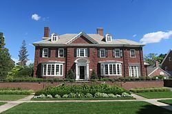
The Freeman Plat Historic District is a residential historic district on the East Side of Providence, Rhode Island. The district is a well-preserved example of an early-20th-century planned residential area, encompassing some 50 acres (20 ha). It is roughly bounded by Sessions Street, Morris Avenue, Laurel Avenue, and Wayland Avenue, and consists of a network of generously-landscaped winding roads, laid out in consultation with the Olmsted Brothers design firm. The houses built are generally of high quality, many of them architect-designed, with architecturally diverse revival styles popular at the time. The area was developed between 1916 and 1929 by John Freeman, who owned a country estate in the area, and sought a way to develop the largely swampy tract.
The district was listed on the National Register of Historic Places in 1995.