
Elevation 276 m | ||
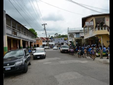 | ||
Driving through frankfield clarendon
Frankfield is a town in the parish of Clarendon in central Jamaica. It is located near the top of Jamaica's central ridge of mountains overlooking the south coast. The Rio Minho river runs through the town in a shallow gorge.
Contents
- Driving through frankfield clarendon
- Map of Frankfield Jamaica
- Grace the hog rider of frankfield clarendon
- Road
- Rail
- References
Map of Frankfield, Jamaica
Grace the hog rider of frankfield clarendon
Road
Frankfield is on the B4 road which climbs up from Trout Hall in the south, crosses into the town from the south east via a bridge over the Rio Minho, passes through the town's central square and continues north towards Grantham and Spauldings. From the town center going towards the south west a lesser road connects Frankfield with Nine Turns, Smithville, Whakefield, Thompson Town, Mocho, Four Paths and May Pen.
Rail
From 1925 to 1974 Frankfield railway station was the terminus of a 21 mile railway branch line from May Pen.
References
Frankfield Wikipedia(Text) CC BY-SA