Puneet Varma (Editor)

Fourcès

Updated on
Edit
Like
Comment
Share on FacebookTweet on TwitterShare on LinkedInShare on Reddit
Country
  
France

Department
  
Gers

Population (2008)
  
290

Area
  
23.72 km²

Arrondissement
  
Condom

Region
  
Occitanie

Canton
  
Montréal

Time zone
  
CET (UTC+1)

Local time
  
Wednesday 6:41 PM

Fourcès wwwlesplusbeauxvillagesdefranceorgfilesph

Weather
  
15°C, Wind N at 6 km/h, 66% Humidity

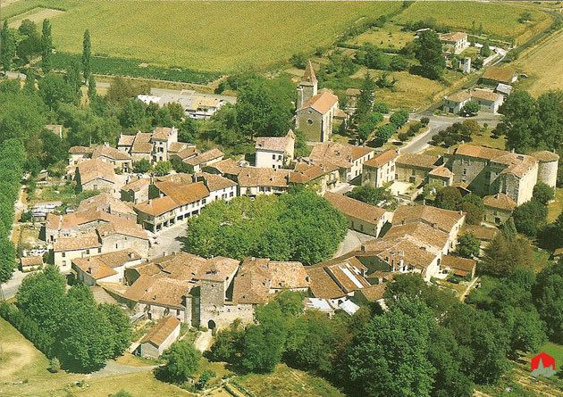
Fourcès is a commune in the Gers department in the Occitanie region in southwestern France known for its circular place.

Contents

Map of 32250 Fourc%C3%A8s, France

Geography

Fourcès lies near Castelnau-d'Auzan and Montréal.

The Auzoue flows north through the middle of the commune. The village lies in the middle of the commune, on the left bank of the Auzoue.

Sights

Fourcès is a typical medieval bastide, a little village where the houses are built in a circle to allow a proper defence.

The following are notable sights:

  • The arena for the course Landaise for example in Castelnau-d'Auzan.
  • Old Armagnac caves.
  • The bastide of Bretagne-d'Armagnac.
  • The Bastide Gasconne of Fourcès.
  • The city of Montréal-du-Gers with a medieval bastide.
  • The city of Eauze and its Roman treasure.
  • The fortified village of Larressingle.
  • The Gallo-Roman villa of Séviac, in Montréal-du-Gers.
  • The Ganaderia de Buros.
  • The museum of D'Artagnan in Lupiac.
  • The Spa of Barbotan-les-Thermes in Cazaubon.
  • References

    Fourcès Wikipedia